San Andrés Enguaro geodata
San Andrés Enguaro (Guanajuato) is a populated place; located in Mexico in America/Mexico_City (GMT-6) time zone. With population of 1,385 people, there are 6250 cities with bigger population in this country. Compared to other cities in Mexico, 61.2% of cities are located further ↓South; 75.2% of cities are located further →East and 61.2% of cities have lower elevation than San Andrés Enguaro. Note1


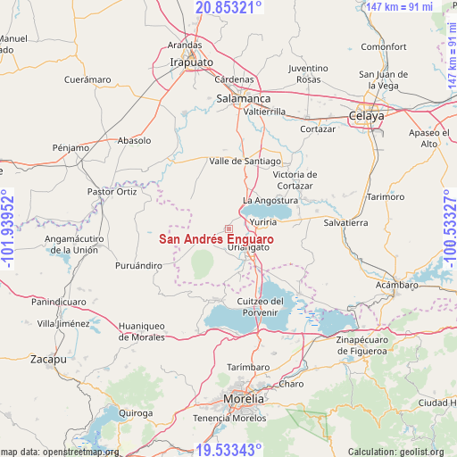
San Andrés Enguaro GPS coordinates[2]
20° 11' 40.992" North, 101° 14' 11.004" West
| Map corner | latitude | longitude |
|---|---|---|
| Upper-left | 20.85321°, | -101.93952° |
| Center: | 20.19472°, | -101.23639° |
| Lower-right: | 19.53343°, | -100.53327° |
| Map W x H: | 146.7×146.7 km | = 91.2×91.2mi |
| max Lat: | 32.7° ⇑38.8% North |
| San Andrés Enguaro: | 20.19472° |
| min Lat: | ⇓61.2% South 14.53588° |
| min Long | San Andrés Eng | max Long |
| -117.105° | -101.23639° | -86.73105° |
| W 24.8%⇐ | ⇒75.2% E |
Elevation
Elevation of San Andrés Enguaro is 1747 m = 5732 ft, and this is 493.3 m = 1618 ft above average elevation for this country.
| Max E: |
3497 m = 11473 ft | 38.8% |
| San Andrés Enguaro | 1747 m 5732 ft | |
| Avg. | 1253.7 m = 4113 ft | |
Min E: |
-1 m = -3 ft | 61.2% |
See also: Mexico elevation on elevation.city.
Geographical zone
San Andrés Enguaro is located in North Torrid zone (between Equator and Tropic of Cancer). Distance of this Northern Tropic circle is 360.5 km =224 mi to North.| Distance of | km | miles | from San Andrés Enguaro |
|---|---|---|---|
| North Pole | 7761.6 | 4822.8 | to North |
| Arctic Circle | 5155.7 | 3203.6 | to North |
| Tropic Cancer | 360.5 | 224 | to North |
| Equator | 2245.4 | 1395.2 | to South |


Nearby cities:
15 places around San Andrés Enguaro: (largest is in red/bold)
• Colonia Juárez
10.8 km =6.7 mi,  121°
121°
• El Canario
11.2 km =7 mi,  247°
247°
• El Moral
9 km =5.6 mi,  217°
217°
• El Tigre
5.6 km =3.5 mi,  322°
322°
• Joconoxtle
7.6 km =4.7 mi,  312°
312°
• Juan Lucas
7.3 km =4.5 mi,  257°
257°
• Las Misiones
7.9 km =4.9 mi, 118°
• Monte de los Juárez
2 km =1.2 mi,  229°
229°
• Moroleón
9 km =5.6 mi,  148°
148°
• Ochomitas
4.5 km =2.8 mi,  44°
44°
• Palo Alto
8.9 km =5.5 mi, 310°
• Parangarico
7.4 km =4.6 mi,  92°
92°
• San Miguel el Alto (San Miguelito)
6.1 km =3.8 mi,  75°
75°
• Uriangato
8.2 km =5.1 mi,  136°
136°
• Yuriria
11 km =6.8 mi, 80°
Sources, notices
• [Note1] Compared only with cities in Mexico existing in our database
• [Src1] Map data: © OpenStreetMap contributors (CC-BY-SA)
• [Src2] Other city data from geonames.org with taken over terms of usage.
• [Src3] Geographical zone / Annual Mean Temperature by Robert A. Rohde @ Wikipedia
