Ahuacachahue (Ndog'yo Itún Tichi) geodata
Ahuacachahue (Ndog'yo Itún Tichi) (Guerrero) is a populated place; located in Mexico in America/Mexico_City (GMT-6) time zone. With population of 1,313 people, there are 6610 cities with bigger population in this country. Compared to other cities in Mexico, 91.3% of cities are located further ↑North; 50.4% of cities are located further ←West and 65.4% of cities have higher elevation than Ahuacachahue (Ndog'yo Itún Tichi). Note1
Current local time in Ahuacachahue (Ndog'yo Itún Tichi):
12:35 PM, MondayDifference from your time zone: hours


Ahuacachahue (Ndog'yo Itún Tichi) GPS coordinates[2]
16° 49' 42.996" North, 98° 59' 8.016" West
| Map corner | latitude | longitude |
|---|---|---|
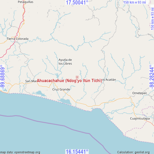
| Upper-left | 17.50041°, | -99.68869° |
| Center: | 16.82861°, | -98.98556° |
| Lower-right: | 16.15441°, | -98.28244° |
| Map W x H: | 149.7×149.7 km | = 93×93mi |
| max Lat: | 32.7° ⇑91.3% North |
| Ahuacachahue (Ndog'yo Itún Tichi): | 16.82861° |
| min Lat: | ⇓8.7% South 14.53588° |
| min Long | Ahuacachahue (N | max Long |
| -117.105° | -98.98556° | -86.73105° |
| W 50.4%⇐ | ⇒49.6% E |
Elevation
Elevation of Ahuacachahue (Ndog'yo Itún Tichi) is 666 m = 2185 ft, and this is 587.7 m = 1928 ft below average elevation for this country.
| Max E: |
3497 m = 11473 ft | 65.4% |
| Avg. | 1253.7 m = 4113 ft | |
| Ahuacachahue (Ndog'yo Itún Tichi) | 666 m = 2185 ft | |
Min E: |
-1 m = -3 ft | 34.6% |
See also: Mexico elevation on elevation.city.
Geographical zone
Ahuacachahue (Ndog'yo Itún Tichi) is located in North Torrid zone (between Equator and Tropic of Cancer). Distance of this Northern Tropic circle is 734.8 km =456.6 mi to North.| Distance of | km | miles | from Ahuacachahue (Ndog'yo Itún Tichi) |
|---|---|---|---|
| North Pole | 8135.9 | 5055.4 | to North |
| Arctic Circle | 5530 | 3436.2 | to North |
| Tropic Cancer | 734.8 | 456.6 | to North |
| Equator | 1871.2 | 1162.7 | to South |


Nearby cities:
15 places around Ahuacachahue (Ndog'yo Itún Tichi): (largest is in red/bold)
• Coacoyulichán
6.5 km =4 mi,  125°
125°
• Cuautepec
8.9 km =5.5 mi,  191°
191°
• El Coquillo
12.7 km =7.9 mi,  153°
153°
• El Mesón
8 km =5 mi,  283°
283°
• El Paraíso
11.6 km =7.2 mi,  352°
352°
• El Zapote
11.5 km =7.1 mi,  274°
274°
• Huamuchititán (El Huamuchito)
9.7 km =6 mi,  160°
160°
• La Angostura
7.2 km =4.5 mi,  318°
318°
• La Azozuca
6.1 km =3.8 mi,  262°
262°
• La Concordia
8.6 km =5.3 mi,  6°
6°
• La Dicha
7.3 km =4.5 mi,  201°
201°
• Mesón Zapote
4 km =2.5 mi,  29°
29°
• Poza Verde
8.7 km =5.4 mi,  108°
108°
• San Antonio Abad
12.2 km =7.6 mi,  304°
304°
• Tonalá
8.2 km =5.1 mi, 296°
Sources, notices
• [Note1] Compared only with cities in Mexico existing in our database
• [Src1] Map data: © OpenStreetMap contributors (CC-BY-SA)
• [Src2] Other city data from geonames.org with taken over terms of usage.
• [Src3] Geographical zone / Annual Mean Temperature by Robert A. Rohde @ Wikipedia
