El Coquillo geodata
El Coquillo (Guerrero) is a populated place; located in Mexico in America/Mexico_City (GMT-6) time zone. With population of 550 people, there are 15494 cities with bigger population in this country. Compared to other cities in Mexico, 92.6% of cities are located further ↑North; 51.4% of cities are located further ←West and 76.4% of cities have higher elevation than El Coquillo. Note1


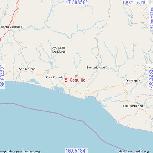
El Coquillo GPS coordinates[2]
16° 43' 35.004" North, 98° 55' 53.004" West
| Map corner | latitude | longitude |
|---|---|---|
| Upper-left | 17.39856°, | -99.63452° |
| Center: | 16.72639°, | -98.93139° |
| Lower-right: | 16.05184°, | -98.22827° |
| Map W x H: | 149.7×149.7 km | = 93×93mi |
| max Lat: | 32.7° ⇑92.6% North |
| El Coquillo: | 16.72639° |
| min Lat: | ⇓7.4% South 14.53588° |
| min Long | El Coquillo | max Long |
| -117.105° | -98.93139° | -86.73105° |
| W 51.4%⇐ | ⇒48.6% E |
Elevation
Elevation of El Coquillo is 172 m = 564 ft, and this is 1081.7 m = 3549 ft below average elevation for this country.
| Max E: |
3497 m = 11473 ft | 76.4% |
| Avg. | 1253.7 m = 4113 ft | |
| El Coquillo | 172 m = 564 ft | |
Min E: |
-1 m = -3 ft | 23.6% |
See also: Mexico elevation on elevation.city.
Geographical zone
El Coquillo is located in North Torrid zone (between Equator and Tropic of Cancer). Distance of this Northern Tropic circle is 746.1 km =463.6 mi to North.| Distance of | km | miles | from El Coquillo |
|---|---|---|---|
| North Pole | 8147.3 | 5062.5 | to North |
| Arctic Circle | 5541.4 | 3443.3 | to North |
| Tropic Cancer | 746.1 | 463.6 | to North |
| Equator | 1859.8 | 1155.6 | to South |


Nearby cities:
15 places around El Coquillo: (largest is in red/bold)
• Ahuacachahue (Ndog'yo Itún Tichi)
12.7 km =7.9 mi,  333°
333°
• Atrixco
10.2 km =6.3 mi,  182°
182°
• Coacoyulichán
7.6 km =4.7 mi,  356°
356°
• Copala
14.1 km =8.8 mi,  200°
200°
• Cuautepec
8 km =5 mi,  289°
289°
• El Carrizo
14.2 km =8.8 mi,  226°
226°
• El Llano
3.9 km =2.4 mi,  216°
216°
• El Pabellón
10.6 km =6.6 mi,  238°
238°
• El Salto
8.3 km =5.2 mi, 236°
• Huamuchititán (El Huamuchito)
3.5 km =2.2 mi,  310°
310°
• Jalapa
13.3 km =8.3 mi,  263°
263°
• La Dicha
9.6 km =6 mi,  298°
298°
• Mesón Zapote
15.4 km =9.6 mi,  345°
345°
• Poza Verde
9 km =5.6 mi,  16°
16°
• Tepantitlán
15.1 km =9.4 mi,  134°
134°
Sources, notices
• [Note1] Compared only with cities in Mexico existing in our database
• [Src1] Map data: © OpenStreetMap contributors (CC-BY-SA)
• [Src2] Other city data from geonames.org with taken over terms of usage.
• [Src3] Geographical zone / Annual Mean Temperature by Robert A. Rohde @ Wikipedia
