Cuautepec geodata
Cuautepec (Guerrero) is a seat of a second-order administrative division; located in Mexico in America/Mexico_City (GMT-6) time zone. With population of 3,567 people, there are 2562 cities with bigger population in this country. Compared to other cities in Mexico, 92.3% of cities are located further ↑North; 50.1% of cities are located further ←West and 75.7% of cities have higher elevation than Cuautepec. Note1


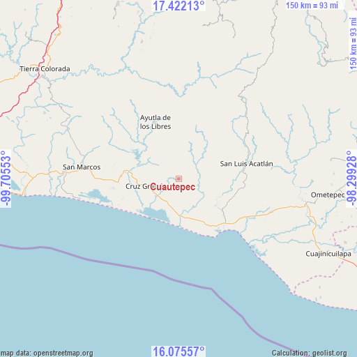
Cuautepec GPS coordinates[2]
16° 45' 0.144" North, 99° 0' 8.64" West
| Map corner | latitude | longitude |
|---|---|---|
| Upper-left | 17.42213°, | -99.70553° |
| Center: | 16.75004°, | -99.0024° |
| Lower-right: | 16.07557°, | -98.29928° |
| Map W x H: | 149.7×149.7 km | = 93×93mi |
| max Lat: | 32.7° ⇑92.3% North |
| Cuautepec: | 16.75004° |
| min Lat: | ⇓7.7% South 14.53588° |
| min Long | Cuautepec | max Long |
| -117.105° | -99.0024° | -86.73105° |
| W 50.1%⇐ | ⇒49.9% E |
Elevation
Elevation of Cuautepec is 200 m = 656 ft, and this is 1053.7 m = 3457 ft below average elevation for this country.
| Max E: |
3497 m = 11473 ft | 75.7% |
| Avg. | 1253.7 m = 4113 ft | |
| Cuautepec | 200 m = 656 ft | |
Min E: |
-1 m = -3 ft | 24.3% |
See also: Mexico elevation on elevation.city.
Geographical zone
Cuautepec is located in North Torrid zone (between Equator and Tropic of Cancer). Distance of this Northern Tropic circle is 743.5 km =462 mi to North.| Distance of | km | miles | from Cuautepec |
|---|---|---|---|
| North Pole | 8144.6 | 5060.8 | to North |
| Arctic Circle | 5538.7 | 3441.6 | to North |
| Tropic Cancer | 743.5 | 462 | to North |
| Equator | 1862.4 | 1157.2 | to South |


Nearby cities:
15 places around Cuautepec: (largest is in red/bold)
• Ahuacachahue (Ndog'yo Itún Tichi)
8.9 km =5.5 mi,  11°
11°
• Coacoyulichán
8.7 km =5.4 mi,  55°
55°
• Cruz Grande
13.3 km =8.3 mi,  256°
256°
• El Carrizo
12.7 km =7.9 mi,  192°
192°
• El Coquillo
8 km =5 mi,  109°
109°
• El Llano
7.8 km =4.8 mi,  137°
137°
• El Mesón
12.2 km =7.6 mi,  330°
330°
• El Pabellón
8.3 km =5.2 mi, 190°
• El Salto
7.3 km =4.5 mi,  174°
174°
• Huamuchititán (El Huamuchito)
5 km =3.1 mi,  94°
94°
• Jalapa
7.1 km =4.4 mi,  233°
233°
• La Azozuca
9 km =5.6 mi, 332°
• La Dicha
2.1 km =1.3 mi,  335°
335°
• Mesón Zapote
12.8 km =8 mi,  16°
16°
• Poza Verde
11.7 km =7.3 mi, 59°
Sources, notices
• [Note1] Compared only with cities in Mexico existing in our database
• [Src1] Map data: © OpenStreetMap contributors (CC-BY-SA)
• [Src2] Other city data from geonames.org with taken over terms of usage.
• [Src3] Geographical zone / Annual Mean Temperature by Robert A. Rohde @ Wikipedia
