El Pueblito (Garbanzal) geodata
El Pueblito (Garbanzal) (Veracruz) is a populated place; located in Mexico in America/Mexico_City (GMT-6) time zone. With population of 1,090 people, there are 7984 cities with bigger population in this country. Compared to other cities in Mexico, 52% of cities are located further ↑North; 75.8% of cities are located further ←West and 50.4% of cities have higher elevation than El Pueblito (Garbanzal). Note1
Current local time in El Pueblito (Garbanzal):
06:50 AM, WednesdayDifference from your time zone: hours


El Pueblito (Garbanzal) GPS coordinates[2]
19° 35' 38.004" North, 96° 55' 27.012" West
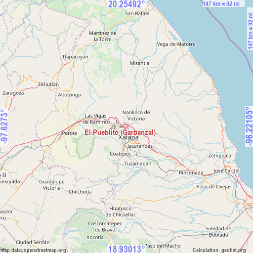
| Map corner | latitude | longitude |
|---|---|---|
| Upper-left | 20.25492°, | -97.6273° |
| Center: | 19.59389°, | -96.92417° |
| Lower-right: | 18.93013°, | -96.22105° |
| Map W x H: | 147.3×147.3 km | = 91.5×91.5mi |
| max Lat: | 32.7° ⇑52% North |
| El Pueblito (Garbanzal): | 19.59389° |
| min Lat: | ⇓48% South 14.53588° |
| min Long | El Pueblito (Ga | max Long |
| -117.105° | -96.92417° | -86.73105° |
| W 75.8%⇐ | ⇒24.2% E |
Elevation
Elevation of El Pueblito (Garbanzal) is 1412 m = 4633 ft, and this is 158.3 m = 519 ft above average elevation for this country.
| Max E: |
3497 m = 11473 ft | 50.4% |
| El Pueblito (Garbanzal) | 1412 m 4633 ft | |
| Avg. | 1253.7 m = 4113 ft | |
Min E: |
-1 m = -3 ft | 49.6% |
See also: Mexico elevation on elevation.city.
Geographical zone
El Pueblito (Garbanzal) is located in North Torrid zone (between Equator and Tropic of Cancer). Distance of this Northern Tropic circle is 427.3 km =265.5 mi to North.| Distance of | km | miles | from El Pueblito (Garbanzal) |
|---|---|---|---|
| North Pole | 7828.4 | 4864.3 | to North |
| Arctic Circle | 5222.5 | 3245.1 | to North |
| Tropic Cancer | 427.3 | 265.5 | to North |
| Equator | 2178.6 | 1353.7 | to South |


Nearby cities:
15 places around El Pueblito (Garbanzal): (largest is in red/bold)
• Banderilla
1.5 km =0.9 mi,  248°
248°
• Carolino Anaya (Espina Blanca)
6.1 km =3.8 mi,  227°
227°
• Chiltoyac
6.3 km =3.9 mi,  107°
107°
• El Espinal
6.4 km =4 mi,  57°
57°
• El Rosario
4.7 km =2.9 mi,  263°
263°
• Guadalupe Victoria
5.8 km =3.6 mi,  221°
221°
• Jilotepec
3.5 km =2.2 mi,  304°
304°
• La Concepción
2.9 km =1.8 mi, 61°
• La Haciendita
3 km =1.9 mi,  138°
138°
• Las Lomas
3.5 km =2.2 mi,  22°
22°
• Linderos
5.9 km =3.7 mi, 303°
• Piedra de Agua
4.2 km =2.6 mi,  285°
285°
• Piletas
5.7 km =3.5 mi, 263°
• Tlalnelhuayocan
6.1 km =3.8 mi,  240°
240°
• Xaltepec
1.1 km =0.7 mi,  306°
306°
Sources, notices
• [Note1] Compared only with cities in Mexico existing in our database
• [Src1] Map data: © OpenStreetMap contributors (CC-BY-SA)
• [Src2] Other city data from geonames.org with taken over terms of usage.
• [Src3] Geographical zone / Annual Mean Temperature by Robert A. Rohde @ Wikipedia
