Jilotepec geodata
Jilotepec (Veracruz) is a seat of a second-order administrative division; located in Mexico in America/Mexico_City (GMT-6) time zone. With population of 3,871 people, there are 2367 cities with bigger population in this country. Compared to other cities in Mexico, 51.6% of cities are located further ↑North; 75.5% of cities are located further ←West and 51% of cities have higher elevation than Jilotepec. Note1


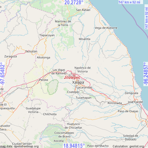
Jilotepec GPS coordinates[2]
19° 36' 42.624" North, 96° 57' 6.084" West
| Map corner | latitude | longitude |
|---|---|---|
| Upper-left | 20.2728°, | -97.65482° |
| Center: | 19.61184°, | -96.95169° |
| Lower-right: | 18.94815°, | -96.24857° |
| Map W x H: | 147.3×147.3 km | = 91.5×91.5mi |
| max Lat: | 32.7° ⇑51.6% North |
| Jilotepec: | 19.61184° |
| min Lat: | ⇓48.4% South 14.53588° |
| min Long | Jilotepec | max Long |
| -117.105° | -96.95169° | -86.73105° |
| W 75.5%⇐ | ⇒24.5% E |
Elevation
Elevation of Jilotepec is 1382 m = 4534 ft, and this is 128.3 m = 421 ft above average elevation for this country.
| Max E: |
3497 m = 11473 ft | 51% |
| Jilotepec | 1382 m 4534 ft | |
| Avg. | 1253.7 m = 4113 ft | |
Min E: |
-1 m = -3 ft | 49% |
See also: Mexico elevation on elevation.city.
Geographical zone
Jilotepec is located in North Torrid zone (between Equator and Tropic of Cancer). Distance of this Northern Tropic circle is 425.3 km =264.3 mi to North.| Distance of | km | miles | from Jilotepec |
|---|---|---|---|
| North Pole | 7826.4 | 4863.1 | to North |
| Arctic Circle | 5220.5 | 3243.9 | to North |
| Tropic Cancer | 425.3 | 264.3 | to North |
| Equator | 2180.6 | 1355 | to South |


Nearby cities:
15 places around Jilotepec: (largest is in red/bold)
• Banderilla
3 km =1.9 mi,  149°
149°
• Coacoatzintla
4.6 km =2.9 mi,  14°
14°
• El Fresno
4.4 km =2.7 mi,  311°
311°
• El Pueblito (Garbanzal)
3.5 km =2.2 mi,  124°
124°
• El Rosario
3.1 km =1.9 mi,  215°
215°
• Guadalupe Victoria
6.4 km =4 mi,  188°
188°
• La Concepción
5.4 km =3.4 mi,  96°
96°
• Las Lomas
4.4 km =2.7 mi,  73°
73°
• Linderos
2.4 km =1.5 mi,  302°
302°
• Los Planes (Cerro Gordo)
6.3 km =3.9 mi,  24°
24°
• Piedra de Agua
1.5 km =0.9 mi,  233°
233°
• Piletas
3.9 km =2.4 mi, 226°
• Rafael Lucio
4.5 km =2.8 mi,  242°
242°
• Tlalnelhuayocan
5.6 km =3.5 mi,  206°
206°
• Xaltepec
2.4 km =1.5 mi, 123°
Sources, notices
• [Note1] Compared only with cities in Mexico existing in our database
• [Src1] Map data: © OpenStreetMap contributors (CC-BY-SA)
• [Src2] Other city data from geonames.org with taken over terms of usage.
• [Src3] Geographical zone / Annual Mean Temperature by Robert A. Rohde @ Wikipedia
