General Luis Felipe Domínguez Suárez geodata
General Luis Felipe Domínguez Suárez (Tabasco) is a populated place; located in Mexico in America/Mexico_City (GMT-6) time zone. With population of 1,049 people, there are 8312 cities with bigger population in this country. Compared to other cities in Mexico, 81.7% of cities are located further ↑North; 96.3% of cities are located further ←West and 88.3% of cities have higher elevation than General Luis Felipe Domínguez Suárez. Note1
Current local time in General Luis Felipe Domínguez Suárez:
06:52 AM, WednesdayDifference from your time zone: hours


General Luis Felipe Domínguez Suárez GPS coordinates[2]
17° 39' 23.004" North, 91° 32' 12.012" West
| Map corner | latitude | longitude |
|---|---|---|
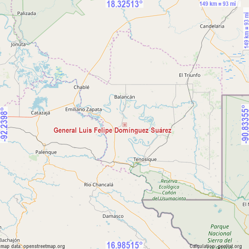
| Upper-left | 18.32513°, | -92.2398° |
| Center: | 17.65639°, | -91.53667° |
| Lower-right: | 16.98515°, | -90.83355° |
| Map W x H: | 149×149 km | = 92.6×92.6mi |
| max Lat: | 32.7° ⇑81.7% North |
| General Luis Felipe Domínguez Suárez: | 17.65639° |
| min Lat: | ⇓18.3% South 14.53588° |
| min Long | General Luis Fe | max Long |
| -117.105° | -91.53667° | -86.73105° |
| W 96.3%⇐ | ⇒3.7% E |
Elevation
Elevation of General Luis Felipe Domínguez Suárez is 29 m = 95 ft, and this is 1224.7 m = 4018 ft below average elevation for this country.
| Max E: |
3497 m = 11473 ft | 88.3% |
| Avg. | 1253.7 m = 4113 ft | |
| General Luis Felipe Domínguez Suárez | 29 m = 95 ft | |
Min E: |
-1 m = -3 ft | 11.7% |
See also: Mexico elevation on elevation.city.
Geographical zone
General Luis Felipe Domínguez Suárez is located in North Torrid zone (between Equator and Tropic of Cancer). Distance of this Northern Tropic circle is 642.7 km =399.4 mi to North.| Distance of | km | miles | from General Luis Felipe Domínguez Suárez |
|---|---|---|---|
| North Pole | 8043.9 | 4998.2 | to North |
| Arctic Circle | 5438 | 3379 | to North |
| Tropic Cancer | 642.7 | 399.4 | to North |
| Equator | 1963.2 | 1219.9 | to South |


Nearby cities:
15 places around General Luis Felipe Domínguez Suárez: (largest is in red/bold)
• Arena de Hidalgo
22.7 km =14.1 mi,  193°
193°
• Balancán
17 km =10.6 mi,  359°
359°
• Benito Juárez Centro
18 km =11.2 mi,  250°
250°
• Chacama
8.4 km =5.2 mi,  272°
272°
• Emiliano Zapata
26.1 km =16.2 mi,  291°
291°
• Estapilla
18.7 km =11.6 mi,  131°
131°
• La Isla
20.3 km =12.6 mi,  164°
164°
• La Libertad
19.8 km =12.3 mi,  280°
280°
• Leona Vicario
4 km =2.5 mi,  351°
351°
• Missicab (La Pita)
25.8 km =16 mi,  40°
40°
• Multé
17 km =10.6 mi,  77°
77°
• Netzahualcóyotl
11.6 km =7.2 mi,  58°
58°
• Tenosique
23.7 km =14.7 mi,  149°
149°
• Usumacinta
12.4 km =7.7 mi, 158°
• Vicente Guerrero
16.2 km =10.1 mi,  319°
319°
Sources, notices
• [Note1] Compared only with cities in Mexico existing in our database
• [Src1] Map data: © OpenStreetMap contributors (CC-BY-SA)
• [Src2] Other city data from geonames.org with taken over terms of usage.
• [Src3] Geographical zone / Annual Mean Temperature by Robert A. Rohde @ Wikipedia
