La Isla geodata
La Isla (Tabasco) is a populated place; located in Mexico in America/Mexico_City (GMT-6) time zone. With population of 556 people, there are 15345 cities with bigger population in this country. Compared to other cities in Mexico, 83.3% of cities are located further ↑North; 96.3% of cities are located further ←West and 91.2% of cities have higher elevation than La Isla. Note1


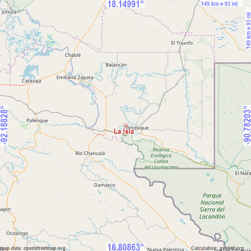
La Isla GPS coordinates[2]
17° 28' 49.836" North, 91° 29' 6.54" West
| Map corner | latitude | longitude |
|---|---|---|
| Upper-left | 18.14991°, | -92.18828° |
| Center: | 17.48051°, | -91.48515° |
| Lower-right: | 16.80863°, | -90.78203° |
| Map W x H: | 149.1×149.1 km | = 92.6×92.6mi |
| max Lat: | 32.7° ⇑83.3% North |
| La Isla: | 17.48051° |
| min Lat: | ⇓16.7% South 14.53588° |
| min Long | La Isla | max Long |
| -117.105° | -91.48515° | -86.73105° |
| W 96.3%⇐ | ⇒3.7% E |
Elevation
Elevation of La Isla is 21 m = 69 ft, and this is 1232.7 m = 4044 ft below average elevation for this country.
| Max E: |
3497 m = 11473 ft | 91.2% |
| Avg. | 1253.7 m = 4113 ft | |
| La Isla | 21 m = 69 ft | |
Min E: |
-1 m = -3 ft | 8.8% |
See also: Mexico elevation on elevation.city.
Geographical zone
La Isla is located in North Torrid zone (between Equator and Tropic of Cancer). Distance of this Northern Tropic circle is 662.3 km =411.5 mi to North.| Distance of | km | miles | from La Isla |
|---|---|---|---|
| North Pole | 8063.4 | 5010.4 | to North |
| Arctic Circle | 5457.5 | 3391.1 | to North |
| Tropic Cancer | 662.3 | 411.5 | to North |
| Equator | 1943.7 | 1207.8 | to South |


Nearby cities:
15 places around La Isla: (largest is in red/bold)
• Arena de Hidalgo
11.2 km =7 mi,  257°
257°
• Certeza
12.5 km =7.8 mi,  100°
100°
• Chacama
24.3 km =15.1 mi,  325°
325°
• El Clavo
18.7 km =11.6 mi,  235°
235°
• El Desierto
22.4 km =13.9 mi, 256°
• El Edén
24.3 km =15.1 mi,  198°
198°
• Estapilla
11.1 km =6.9 mi,  49°
49°
• General Luis Felipe Domínguez Suárez
20.3 km =12.6 mi,  344°
344°
• Leona Vicario
24.3 km =15.1 mi,  345°
345°
• Lázaro Cárdenas
15 km =9.3 mi,  208°
208°
• Mactún
23.7 km =14.7 mi,  59°
59°
• Multé
25.7 km =16 mi,  25°
25°
• Netzahualcóyotl
26 km =16.2 mi,  9°
9°
• Tenosique
6.6 km =4.1 mi, 97°
• Usumacinta
8.1 km =5 mi, 353°
Sources, notices
• [Note1] Compared only with cities in Mexico existing in our database
• [Src1] Map data: © OpenStreetMap contributors (CC-BY-SA)
• [Src2] Other city data from geonames.org with taken over terms of usage.
• [Src3] Geographical zone / Annual Mean Temperature by Robert A. Rohde @ Wikipedia
