Barranca Prieta geodata
Barranca Prieta (State of Mexico) is a populated place; located in Mexico in America/Mexico_City (GMT-6) time zone. With population of 913 people, there are 9556 cities with bigger population in this country. Compared to other cities in Mexico, 54.1% of cities are located further ↓South; 53% of cities are located further →East and 85.1% of cities have lower elevation than Barranca Prieta. Note1


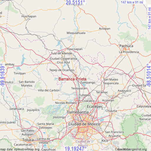
Barranca Prieta GPS coordinates[2]
19° 51' 18.576" North, 99° 12' 47.736" West
| Map corner | latitude | longitude |
|---|---|---|
| Upper-left | 20.5151°, | -99.91639° |
| Center: | 19.85516°, | -99.21326° |
| Lower-right: | 19.19247°, | -98.51014° |
| Map W x H: | 147.1×147.1 km | = 91.4×91.4mi |
| max Lat: | 32.7° ⇑45.9% North |
| Barranca Prieta: | 19.85516° |
| min Lat: | ⇓54.1% South 14.53588° |
| min Long | Barranca Prieta | max Long |
| -117.105° | -99.21326° | -86.73105° |
| W 47%⇐ | ⇒53% E |
Elevation
Elevation of Barranca Prieta is 2262 m = 7421 ft, and this is 1008.3 m = 3308 ft above average elevation for this country.
| Max E: |
3497 m = 11473 ft | 14.9% |
| Barranca Prieta | 2262 m 7421 ft | |
| Avg. | 1253.7 m = 4113 ft | |
Min E: |
-1 m = -3 ft | 85.1% |
See also: Mexico elevation on elevation.city.
Geographical zone
Barranca Prieta is located in North Torrid zone (between Equator and Tropic of Cancer). Distance of this Northern Tropic circle is 398.2 km =247.4 mi to North.| Distance of | km | miles | from Barranca Prieta |
|---|---|---|---|
| North Pole | 7799.4 | 4846.3 | to North |
| Arctic Circle | 5193.5 | 3227.1 | to North |
| Tropic Cancer | 398.2 | 247.4 | to North |
| Equator | 2207.7 | 1371.8 | to South |


Nearby cities:
15 places around Barranca Prieta: (largest is in red/bold)
• Casa Nueva
2.5 km =1.6 mi,  170°
170°
• Coyotepec
8.7 km =5.4 mi,  179°
179°
• Ex-hacienda de Xalpa
4.9 km =3 mi,  139°
139°
• Huehuetoca
3.2 km =2 mi,  161°
161°
• Jorobas
5.1 km =3.2 mi,  226°
226°
• Paseos de la Pradera
4.8 km =3 mi,  327°
327°
• Praderas del Potrero
3.7 km =2.3 mi, 331°
• Salitrillo
2.9 km =1.8 mi,  185°
185°
• San Bartolo
3.3 km =2.1 mi, 139°
• San Juan Zitlaltepec
8.6 km =5.3 mi,  123°
123°
• San Miguel
8.4 km =5.2 mi,  79°
79°
• San Pedro Xalpa
4.4 km =2.7 mi, 136°
• Santa Teresa
2.4 km =1.5 mi,  241°
241°
• Santiago Tlaltepoxco
5.9 km =3.7 mi,  302°
302°
• Villa URBI del Rey
4.8 km =3 mi,  251°
251°
Sources, notices
• [Note1] Compared only with cities in Mexico existing in our database
• [Src1] Map data: © OpenStreetMap contributors (CC-BY-SA)
• [Src2] Other city data from geonames.org with taken over terms of usage.
• [Src3] Geographical zone / Annual Mean Temperature by Robert A. Rohde @ Wikipedia
