Gonzalo Vázquez Vela geodata
Gonzalo Vázquez Vela (Veracruz) is a populated place; located in Mexico in America/Mexico_City (GMT-6) time zone. With population of 896 people, there are 9729 cities with bigger population in this country. Compared to other cities in Mexico, 63.8% of cities are located further ↑North; 74.2% of cities are located further ←West and 55.4% of cities have lower elevation than Gonzalo Vázquez Vela. Note1
Current local time in Gonzalo Vázquez Vela:
08:32 AM, WednesdayDifference from your time zone: hours


Gonzalo Vázquez Vela GPS coordinates[2]
19° 3' 24.012" North, 97° 3' 6.984" West
| Map corner | latitude | longitude |
|---|---|---|
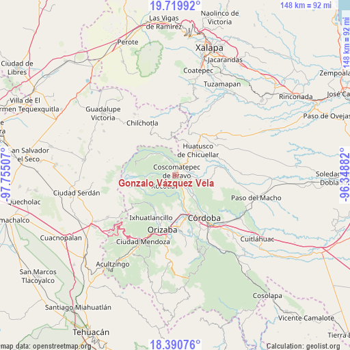
| Upper-left | 19.71992°, | -97.75507° |
| Center: | 19.05667°, | -97.05194° |
| Lower-right: | 18.39076°, | -96.34882° |
| Map W x H: | 147.8×147.8 km | = 91.8×91.8mi |
| max Lat: | 32.7° ⇑63.8% North |
| Gonzalo Vázquez Vela: | 19.05667° |
| min Lat: | ⇓36.2% South 14.53588° |
| min Long | Gonzalo Vázque | max Long |
| -117.105° | -97.05194° | -86.73105° |
| W 74.2%⇐ | ⇒25.8% E |
Elevation
Elevation of Gonzalo Vázquez Vela is 1600 m = 5249 ft, and this is 346.3 m = 1136 ft above average elevation for this country.
| Max E: |
3497 m = 11473 ft | 44.6% |
| Gonzalo Vázquez Vela | 1600 m 5249 ft | |
| Avg. | 1253.7 m = 4113 ft | |
Min E: |
-1 m = -3 ft | 55.4% |
See also: Mexico elevation on elevation.city.
Geographical zone
Gonzalo Vázquez Vela is located in North Torrid zone (between Equator and Tropic of Cancer). Distance of this Northern Tropic circle is 487 km =302.6 mi to North.| Distance of | km | miles | from Gonzalo Vázquez Vela |
|---|---|---|---|
| North Pole | 7888.2 | 4901.5 | to North |
| Arctic Circle | 5282.3 | 3282.3 | to North |
| Tropic Cancer | 487 | 302.6 | to North |
| Equator | 2118.9 | 1316.6 | to South |


Nearby cities:
15 places around Gonzalo Vázquez Vela: (largest is in red/bold)
• Calaquioco
3.4 km =2.1 mi,  148°
148°
• Chocamán
5.3 km =3.3 mi,  158°
158°
• Coscomatepec de Bravo
1.9 km =1.2 mi,  16°
16°
• Huilotla
5 km =3.1 mi,  228°
228°
• Ixtayuca (San Nicolás)
2.7 km =1.7 mi,  281°
281°
• Lázaro Cárdenas
3.8 km =2.4 mi,  39°
39°
• Nicanor Espejo
0.7 km =0.4 mi, 38°
• Rincón Pintor
6.8 km =4.2 mi,  186°
186°
• Tetlaxco
2.2 km =1.4 mi,  214°
214°
• Tlaltengo
5.8 km =3.6 mi,  60°
60°
• Tomatlán
5.3 km =3.3 mi,  122°
122°
• Tozongo
4.9 km =3 mi,  349°
349°
• Xalatlaco
1.4 km =0.9 mi, 124°
• Xonotzintla
6.5 km =4 mi,  171°
171°
• Úrsulo Galván
3.3 km =2.1 mi,  12°
12°
Sources, notices
• [Note1] Compared only with cities in Mexico existing in our database
• [Src1] Map data: © OpenStreetMap contributors (CC-BY-SA)
• [Src2] Other city data from geonames.org with taken over terms of usage.
• [Src3] Geographical zone / Annual Mean Temperature by Robert A. Rohde @ Wikipedia
