Bajo Grande geodata
Bajo Grande (Veracruz) is a populated place; located in Mexico in America/Mexico_City (GMT-6) time zone. With population of 862 people, there are 10147 cities with bigger population in this country. Compared to other cities in Mexico, 69.7% of cities are located further ↑North; 79% of cities are located further ←West and 74.7% of cities have higher elevation than Bajo Grande. Note1


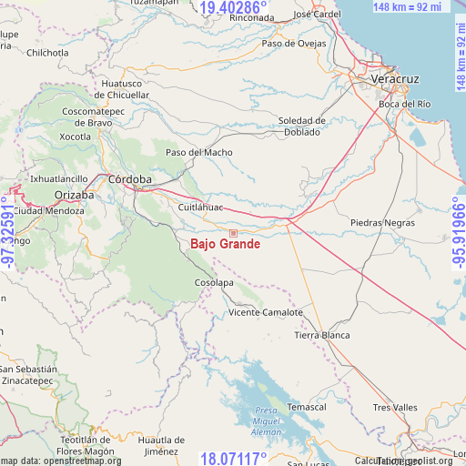
Bajo Grande GPS coordinates[2]
18° 44' 17.988" North, 96° 37' 22.008" West
| Map corner | latitude | longitude |
|---|---|---|
| Upper-left | 19.40286°, | -97.32591° |
| Center: | 18.73833°, | -96.62278° |
| Lower-right: | 18.07117°, | -95.91966° |
| Map W x H: | 148.1×148.1 km | = 92×92mi |
| max Lat: | 32.7° ⇑69.7% North |
| Bajo Grande: | 18.73833° |
| min Lat: | ⇓30.3% South 14.53588° |
| min Long | Bajo Grande | max Long |
| -117.105° | -96.62278° | -86.73105° |
| W 79%⇐ | ⇒21% E |
Elevation
Elevation of Bajo Grande is 231 m = 758 ft, and this is 1022.7 m = 3355 ft below average elevation for this country.
| Max E: |
3497 m = 11473 ft | 74.7% |
| Avg. | 1253.7 m = 4113 ft | |
| Bajo Grande | 231 m = 758 ft | |
Min E: |
-1 m = -3 ft | 25.3% |
See also: Mexico elevation on elevation.city.
Geographical zone
Bajo Grande is located in North Torrid zone (between Equator and Tropic of Cancer). Distance of this Northern Tropic circle is 522.4 km =324.6 mi to North.| Distance of | km | miles | from Bajo Grande |
|---|---|---|---|
| North Pole | 7923.6 | 4923.5 | to North |
| Arctic Circle | 5317.7 | 3304.3 | to North |
| Tropic Cancer | 522.4 | 324.6 | to North |
| Equator | 2083.5 | 1294.6 | to South |


Nearby cities:
15 places around Bajo Grande: (largest is in red/bold)
• Arroyo Azul
11.5 km =7.1 mi,  325°
325°
• Cerro Alto
12 km =7.5 mi,  64°
64°
• Colonia Primero de Mayo
8.2 km =5.1 mi,  173°
173°
• Cruz Tetela
12.3 km =7.6 mi,  244°
244°
• El Palmar
8.5 km =5.3 mi, 328°
• Emiliano Zapata
12.7 km =7.9 mi,  255°
255°
• Loma Angosta
7.5 km =4.7 mi,  311°
311°
• Loma Mulato
2.6 km =1.6 mi,  144°
144°
• Mata Gallina
9.3 km =5.8 mi,  5°
5°
• Mata Naranjo
10.5 km =6.5 mi,  294°
294°
• Mata Tenatito (Casco Hacienda)
4.6 km =2.9 mi,  246°
246°
• Paso Amapa
10.3 km =6.4 mi,  196°
196°
• Paso del Rosario
9.3 km =5.8 mi,  267°
267°
• Río Moreno
7.3 km =4.5 mi, 200°
• Toluquilla Buena Vista
12.8 km =8 mi, 274°
Sources, notices
• [Note1] Compared only with cities in Mexico existing in our database
• [Src1] Map data: © OpenStreetMap contributors (CC-BY-SA)
• [Src2] Other city data from geonames.org with taken over terms of usage.
• [Src3] Geographical zone / Annual Mean Temperature by Robert A. Rohde @ Wikipedia
