Mafafas geodata
Mafafas (Veracruz) is a populated place; located in Mexico in America/Mexico_City (GMT-6) time zone. With population of 1,392 people, there are 6215 cities with bigger population in this country. Compared to other cities in Mexico, 50.7% of cities are located further ↑North; 77.8% of cities are located further ←West and 52.1% of cities have higher elevation than Mafafas. Note1


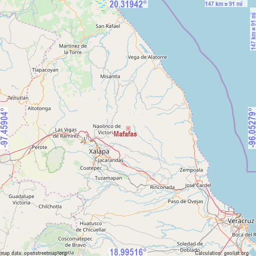
Mafafas GPS coordinates[2]
19° 39' 31.176" North, 96° 45' 21.276" West
| Map corner | latitude | longitude |
|---|---|---|
| Upper-left | 20.31942°, | -97.45904° |
| Center: | 19.65866°, | -96.75591° |
| Lower-right: | 18.99516°, | -96.05279° |
| Map W x H: | 147.2×147.2 km | = 91.5×91.5mi |
| max Lat: | 32.7° ⇑50.7% North |
| Mafafas: | 19.65866° |
| min Lat: | ⇓49.3% South 14.53588° |
| min Long | Mafafas | max Long |
| -117.105° | -96.75591° | -86.73105° |
| W 77.8%⇐ | ⇒22.2% E |
Elevation
Elevation of Mafafas is 1335 m = 4380 ft, and this is 81.3 m = 267 ft above average elevation for this country.
| Max E: |
3497 m = 11473 ft | 52.1% |
| Mafafas | 1335 m 4380 ft | |
| Avg. | 1253.7 m = 4113 ft | |
Min E: |
-1 m = -3 ft | 47.9% |
See also: Mexico elevation on elevation.city.
Geographical zone
Mafafas is located in North Torrid zone (between Equator and Tropic of Cancer). Distance of this Northern Tropic circle is 420.1 km =261 mi to North.| Distance of | km | miles | from Mafafas |
|---|---|---|---|
| North Pole | 7821.2 | 4859.9 | to North |
| Arctic Circle | 5215.3 | 3240.6 | to North |
| Tropic Cancer | 420.1 | 261 | to North |
| Equator | 2185.8 | 1358.2 | to South |


Nearby cities:
15 places around Mafafas: (largest is in red/bold)
• Acatlán
10 km =6.2 mi,  295°
295°
• Almolonga
8.1 km =5 mi,  200°
200°
• Alto Lucero
4.4 km =2.7 mi,  149°
149°
• Cerrillos de Diaz
4.6 km =2.9 mi,  135°
135°
• El Cafetal
5.9 km =3.7 mi,  60°
60°
• El Capulín
9.4 km =5.8 mi,  23°
23°
• El Escalanar
8.5 km =5.3 mi, 21°
• El Huérfano
9.2 km =5.7 mi,  6°
6°
• Enríquez
2.6 km =1.6 mi,  29°
29°
• Las Haldas
7.9 km =4.9 mi,  245°
245°
• Monte Verde Chivería
8 km =5 mi,  51°
51°
• Tepetlán
4.6 km =2.9 mi,  290°
290°
• Tierra Blanca
10.8 km =6.7 mi, 51°
• Vicente Guerrero (Tepetates)
7.6 km =4.7 mi,  225°
225°
• Xomotla
4 km =2.5 mi, 58°
Sources, notices
• [Note1] Compared only with cities in Mexico existing in our database
• [Src1] Map data: © OpenStreetMap contributors (CC-BY-SA)
• [Src2] Other city data from geonames.org with taken over terms of usage.
• [Src3] Geographical zone / Annual Mean Temperature by Robert A. Rohde @ Wikipedia
