La Presa (La Presita) geodata
La Presa (La Presita) (San Luis Potosí) is a populated place; located in Mexico in America/Mexico_City (GMT-6) time zone. With population of 758 people, there are 11551 cities with bigger population in this country. Compared to other cities in Mexico, 83.7% of cities are located further ↓South; 72.9% of cities are located further →East and 65.8% of cities have lower elevation than La Presa (La Presita). Note1
Current local time in La Presa (La Presita):
06:53 AM, WednesdayDifference from your time zone: hours


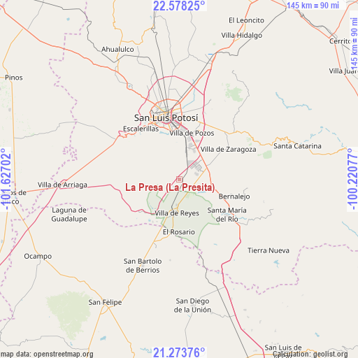
La Presa (La Presita) GPS coordinates[2]
21° 55' 39" North, 100° 55' 26.004" West
| Map corner | latitude | longitude |
|---|---|---|
| Upper-left | 22.57825°, | -101.62702° |
| Center: | 21.9275°, | -100.92389° |
| Lower-right: | 21.27376°, | -100.22077° |
| Map W x H: | 145×145 km | = 90.1×90.1mi |
| max Lat: | 32.7° ⇑16.3% North |
| La Presa (La Presita): | 21.9275° |
| min Lat: | ⇓83.7% South 14.53588° |
| min Long | La Presa (La Pr | max Long |
| -117.105° | -100.92389° | -86.73105° |
| W 27.1%⇐ | ⇒72.9% E |
Elevation
Elevation of La Presa (La Presita) is 1846 m = 6056 ft, and this is 592.3 m = 1943 ft above average elevation for this country.
| Max E: |
3497 m = 11473 ft | 34.2% |
| La Presa (La Presita) | 1846 m 6056 ft | |
| Avg. | 1253.7 m = 4113 ft | |
Min E: |
-1 m = -3 ft | 65.8% |
See also: Mexico elevation on elevation.city.
Geographical zone
La Presa (La Presita) is located in North Torrid zone (between Equator and Tropic of Cancer). Distance of this Northern Tropic circle is 167.8 km =104.3 mi to North.| Distance of | km | miles | from La Presa (La Presita) |
|---|---|---|---|
| North Pole | 7569 | 4703.2 | to North |
| Arctic Circle | 4963.1 | 3083.9 | to North |
| Tropic Cancer | 167.8 | 104.3 | to North |
| Equator | 2438.1 | 1515 | to South |


Nearby cities:
15 places around La Presa (La Presita): (largest is in red/bold)
• Arroyos
14.3 km =8.9 mi,  7°
7°
• Cerro Gordo
13.2 km =8.2 mi,  66°
66°
• Ejido Gogorrón (Ex-Hacienda de Gogorrón)
9.8 km =6.1 mi,  172°
172°
• Ejido el Saucillo
12.5 km =7.8 mi,  215°
215°
• El Mirador
8 km =5 mi,  116°
116°
• El Terrero Sur
12.7 km =7.9 mi, 7°
• Emiliano Zapata
1.3 km =0.8 mi, 122°
• La Pila
13.2 km =8.2 mi,  25°
25°
• Laguna de San Vicente
7 km =4.3 mi, 72°
• Machado
6.1 km =3.8 mi,  192°
192°
• Pardo
8.5 km =5.3 mi, 124°
• Rodrigo
5 km =3.1 mi, 217°
• San Lorenzo
6.2 km =3.9 mi,  112°
112°
• Socavón (El Carmen)
10 km =6.2 mi,  147°
147°
• Villa de Reyes
13.9 km =8.6 mi,  184°
184°
Sources, notices
• [Note1] Compared only with cities in Mexico existing in our database
• [Src1] Map data: © OpenStreetMap contributors (CC-BY-SA)
• [Src2] Other city data from geonames.org with taken over terms of usage.
• [Src3] Geographical zone / Annual Mean Temperature by Robert A. Rohde @ Wikipedia
