Laguna de San Vicente geodata
Laguna de San Vicente (San Luis Potosí) is a populated place; located in Mexico in America/Mexico_City (GMT-6) time zone. With population of 2,762 people, there are 3204 cities with bigger population in this country. Compared to other cities in Mexico, 83.8% of cities are located further ↓South; 72.3% of cities are located further →East and 64.7% of cities have lower elevation than Laguna de San Vicente. Note1
Current local time in Laguna de San Vicente:
08:31 AM, WednesdayDifference from your time zone: hours


Laguna de San Vicente GPS coordinates[2]
21° 56' 45.708" North, 100° 51' 33.336" West
| Map corner | latitude | longitude |
|---|---|---|
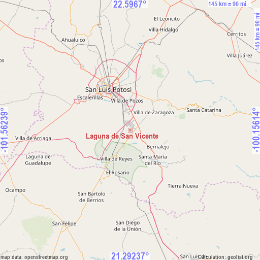
| Upper-left | 22.5967°, | -101.56239° |
| Center: | 21.94603°, | -100.85926° |
| Lower-right: | 21.29237°, | -100.15614° |
| Map W x H: | 145×145 km | = 90.1×90.1mi |
| max Lat: | 32.7° ⇑16.2% North |
| Laguna de San Vicente: | 21.94603° |
| min Lat: | ⇓83.8% South 14.53588° |
| min Long | Laguna de San V | max Long |
| -117.105° | -100.85926° | -86.73105° |
| W 27.7%⇐ | ⇒72.3% E |
Elevation
Elevation of Laguna de San Vicente is 1820 m = 5971 ft, and this is 566.3 m = 1858 ft above average elevation for this country.
| Max E: |
3497 m = 11473 ft | 35.3% |
| Laguna de San Vicente | 1820 m 5971 ft | |
| Avg. | 1253.7 m = 4113 ft | |
Min E: |
-1 m = -3 ft | 64.7% |
See also: Mexico elevation on elevation.city.
Geographical zone
Laguna de San Vicente is located in North Torrid zone (between Equator and Tropic of Cancer). Distance of this Northern Tropic circle is 165.7 km =103 mi to North.| Distance of | km | miles | from Laguna de San Vicente |
|---|---|---|---|
| North Pole | 7566.9 | 4701.9 | to North |
| Arctic Circle | 4961 | 3082.6 | to North |
| Tropic Cancer | 165.7 | 103 | to North |
| Equator | 2440.2 | 1516.3 | to South |


Nearby cities:
15 places around Laguna de San Vicente: (largest is in red/bold)
• Cerro Gordo
6.3 km =3.9 mi,  59°
59°
• El Jaralito
11 km =6.8 mi,  20°
20°
• El Mirador
5.7 km =3.5 mi,  174°
174°
• El Terrero Sur
11.7 km =7.3 mi,  334°
334°
• Emiliano Zapata
6.2 km =3.9 mi,  244°
244°
• Enramadas
10.6 km =6.6 mi,  131°
131°
• La Esperanza
11.9 km =7.4 mi,  54°
54°
• La Pila
9.8 km =6.1 mi,  354°
354°
• La Presa (La Presita)
7 km =4.3 mi,  252°
252°
• Machado
11.3 km =7 mi,  224°
224°
• Pardo
6.9 km =4.3 mi,  177°
177°
• Rodrigo
11.5 km =7.1 mi, 238°
• San Lorenzo
4.5 km =2.8 mi,  191°
191°
• Socavón (El Carmen)
10.6 km =6.6 mi, 187°
• Texas
11.8 km =7.3 mi,  90°
90°
Sources, notices
• [Note1] Compared only with cities in Mexico existing in our database
• [Src1] Map data: © OpenStreetMap contributors (CC-BY-SA)
• [Src2] Other city data from geonames.org with taken over terms of usage.
• [Src3] Geographical zone / Annual Mean Temperature by Robert A. Rohde @ Wikipedia
