Villa Luz geodata
Villa Luz (Chiapas) is a populated place; located in Mexico in America/Mexico_City (GMT-6) time zone. With population of 755 people, there are 11595 cities with bigger population in this country. Compared to other cities in Mexico, 85.5% of cities are located further ↑North; 90.4% of cities are located further ←West and 60.6% of cities have higher elevation than Villa Luz. Note1


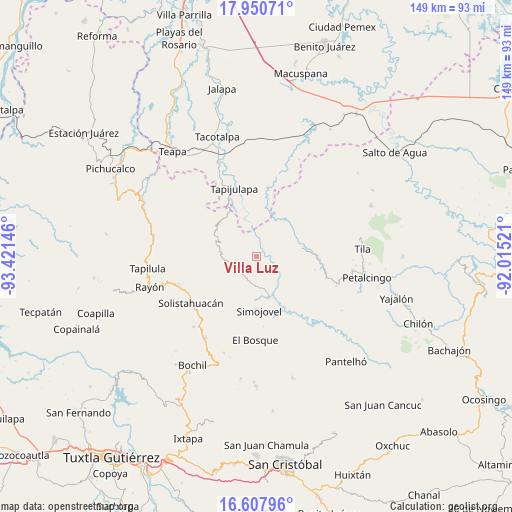
Villa Luz GPS coordinates[2]
17° 16' 50.016" North, 92° 43' 5.988" West
| Map corner | latitude | longitude |
|---|---|---|
| Upper-left | 17.95071°, | -93.42146° |
| Center: | 17.28056°, | -92.71833° |
| Lower-right: | 16.60796°, | -92.01521° |
| Map W x H: | 149.3×149.3 km | = 92.8×92.8mi |
| max Lat: | 32.7° ⇑85.5% North |
| Villa Luz: | 17.28056° |
| min Lat: | ⇓14.5% South 14.53588° |
| min Long | Villa Luz | max Long |
| -117.105° | -92.71833° | -86.73105° |
| W 90.4%⇐ | ⇒9.6% E |
Elevation
Elevation of Villa Luz is 963 m = 3159 ft, and this is 290.7 m = 954 ft below average elevation for this country.
| Max E: |
3497 m = 11473 ft | 60.6% |
| Avg. | 1253.7 m = 4113 ft | |
| Villa Luz | 963 m = 3159 ft | |
Min E: |
-1 m = -3 ft | 39.4% |
See also: Mexico elevation on elevation.city.
Geographical zone
Villa Luz is located in North Torrid zone (between Equator and Tropic of Cancer). Distance of this Northern Tropic circle is 684.5 km =425.3 mi to North.| Distance of | km | miles | from Villa Luz |
|---|---|---|---|
| North Pole | 8085.6 | 5024.2 | to North |
| Arctic Circle | 5479.8 | 3405 | to North |
| Tropic Cancer | 684.5 | 425.3 | to North |
| Equator | 1921.4 | 1193.9 | to South |


Nearby cities:
15 places around Villa Luz: (largest is in red/bold)
• Campamento el Mirador
8.8 km =5.5 mi,  28°
28°
• Cristóbal Colón
10.5 km =6.5 mi,  39°
39°
• Cuitláhuac
8.6 km =5.3 mi,  351°
351°
• El Ocotal
9.6 km =6 mi,  202°
202°
• Emiliano Zapata
8.9 km =5.5 mi,  109°
109°
• Huanal
2.8 km =1.7 mi, 350°
• José María Morelos y Pavón
4.7 km =2.9 mi,  158°
158°
• La Competencia
6.5 km =4 mi,  219°
219°
• La Esperanza
9.4 km =5.8 mi,  292°
292°
• Los Naranjos
10.6 km =6.6 mi,  99°
99°
• Majastic
9.6 km =6 mi,  84°
84°
• Ramos Cubilete
4.6 km =2.9 mi,  121°
121°
• Sombra Carrizal
3.5 km =2.2 mi,  302°
302°
• Zacajtic
5.6 km =3.5 mi,  234°
234°
• Zacatonal de Juárez
8.7 km =5.4 mi,  262°
262°
Sources, notices
• [Note1] Compared only with cities in Mexico existing in our database
• [Src1] Map data: © OpenStreetMap contributors (CC-BY-SA)
• [Src2] Other city data from geonames.org with taken over terms of usage.
• [Src3] Geographical zone / Annual Mean Temperature by Robert A. Rohde @ Wikipedia
