Campamento el Mirador geodata
Campamento el Mirador (Chiapas) is a populated place; located in Mexico in America/Mexico_City (GMT-6) time zone. With population of 611 people, there are 14112 cities with bigger population in this country. Compared to other cities in Mexico, 84.7% of cities are located further ↑North; 90.7% of cities are located further ←West and 61.5% of cities have higher elevation than Campamento el Mirador. Note1
Current local time in Campamento el Mirador:
08:35 AM, WednesdayDifference from your time zone: hours


Campamento el Mirador GPS coordinates[2]
17° 21' 0" North, 92° 40' 41.988" West
| Map corner | latitude | longitude |
|---|---|---|
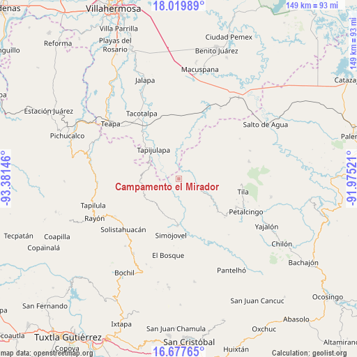
| Upper-left | 18.01989°, | -93.38146° |
| Center: | 17.35°, | -92.67833° |
| Lower-right: | 16.67765°, | -91.97521° |
| Map W x H: | 149.2×149.2 km | = 92.7×92.7mi |
| max Lat: | 32.7° ⇑84.7% North |
| Campamento el Mirador: | 17.35° |
| min Lat: | ⇓15.3% South 14.53588° |
| min Long | Campamento el M | max Long |
| -117.105° | -92.67833° | -86.73105° |
| W 90.7%⇐ | ⇒9.3% E |
Elevation
Elevation of Campamento el Mirador is 907 m = 2976 ft, and this is 346.7 m = 1137 ft below average elevation for this country.
| Max E: |
3497 m = 11473 ft | 61.5% |
| Avg. | 1253.7 m = 4113 ft | |
| Campamento el Mirador | 907 m = 2976 ft | |
Min E: |
-1 m = -3 ft | 38.5% |
See also: Mexico elevation on elevation.city.
Geographical zone
Campamento el Mirador is located in North Torrid zone (between Equator and Tropic of Cancer). Distance of this Northern Tropic circle is 676.8 km =420.5 mi to North.| Distance of | km | miles | from Campamento el Mirador |
|---|---|---|---|
| North Pole | 8077.9 | 5019.4 | to North |
| Arctic Circle | 5472 | 3400.1 | to North |
| Tropic Cancer | 676.8 | 420.5 | to North |
| Equator | 1929.1 | 1198.7 | to South |


Nearby cities:
15 places around Campamento el Mirador: (largest is in red/bold)
• Cristóbal Colón
2.4 km =1.5 mi,  79°
79°
• Cuitláhuac
5.6 km =3.5 mi,  278°
278°
• El Bebedero
6.2 km =3.9 mi,  31°
31°
• Huanal
6.8 km =4.2 mi,  223°
223°
• Jesús Carranza
7.3 km =4.5 mi,  20°
20°
• Libertad
7.8 km =4.8 mi,  329°
329°
• Majastic
8.6 km =5.3 mi,  141°
141°
• Moyos
4 km =2.5 mi, 75°
• Ostelucum
8.5 km =5.3 mi,  87°
87°
• Oxolotán
8.2 km =5.1 mi,  293°
293°
• Raya Zaragoza
6.3 km =3.9 mi,  353°
353°
• Sombra Carrizal
9.3 km =5.8 mi,  231°
231°
• Unión Hidalgo (El Chorro)
8.2 km =5.1 mi, 81°
• Unión Juárez
6.6 km =4.1 mi,  51°
51°
• Villa Luz
8.8 km =5.5 mi,  208°
208°
Sources, notices
• [Note1] Compared only with cities in Mexico existing in our database
• [Src1] Map data: © OpenStreetMap contributors (CC-BY-SA)
• [Src2] Other city data from geonames.org with taken over terms of usage.
• [Src3] Geographical zone / Annual Mean Temperature by Robert A. Rohde @ Wikipedia
