José María Morelos y Pavón geodata
José María Morelos y Pavón (Chiapas) is a populated place; located in Mexico in America/Mexico_City (GMT-6) time zone. With population of 1,143 people, there are 7600 cities with bigger population in this country. Compared to other cities in Mexico, 86% of cities are located further ↑North; 90.5% of cities are located further ←West and 60.1% of cities have higher elevation than José María Morelos y Pavón. Note1
Current local time in José María Morelos y Pavón:
06:47 AM, WednesdayDifference from your time zone: hours


José María Morelos y Pavón GPS coordinates[2]
17° 14' 27.78" North, 92° 42' 8.316" West
| Map corner | latitude | longitude |
|---|---|---|
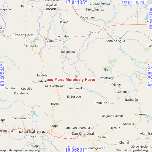
| Upper-left | 17.91135°, | -93.40544° |
| Center: | 17.24105°, | -92.70231° |
| Lower-right: | 16.56831°, | -91.99919° |
| Map W x H: | 149.3×149.3 km | = 92.8×92.8mi |
| max Lat: | 32.7° ⇑86% North |
| José María Morelos y Pavón: | 17.24105° |
| min Lat: | ⇓14% South 14.53588° |
| min Long | José María Mo | max Long |
| -117.105° | -92.70231° | -86.73105° |
| W 90.5%⇐ | ⇒9.5% E |
Elevation
Elevation of José María Morelos y Pavón is 992 m = 3255 ft, and this is 261.7 m = 859 ft below average elevation for this country.
| Max E: |
3497 m = 11473 ft | 60.1% |
| Avg. | 1253.7 m = 4113 ft | |
| José María Morelos y Pavón | 992 m = 3255 ft | |
Min E: |
-1 m = -3 ft | 39.9% |
See also: Mexico elevation on elevation.city.
Geographical zone
José María Morelos y Pavón is located in North Torrid zone (between Equator and Tropic of Cancer). Distance of this Northern Tropic circle is 688.9 km =428.1 mi to North.| Distance of | km | miles | from José María Morelos y Pavón |
|---|---|---|---|
| North Pole | 8090 | 5026.9 | to North |
| Arctic Circle | 5484.1 | 3407.7 | to North |
| Tropic Cancer | 688.9 | 428.1 | to North |
| Equator | 1917 | 1191.2 | to South |


Nearby cities:
15 places around José María Morelos y Pavón: (largest is in red/bold)
• El Azufre
7.3 km =4.5 mi,  124°
124°
• El Ocotal
6.9 km =4.3 mi,  229°
229°
• Emiliano Zapata
6.9 km =4.3 mi,  78°
78°
• Guadalupe Victoria Dos
10.8 km =6.7 mi,  217°
217°
• Huanal
7.5 km =4.7 mi,  343°
343°
• Huitiupán
7.8 km =4.8 mi,  167°
167°
• La Competencia
5.9 km =3.7 mi,  264°
264°
• Los Naranjos
9.1 km =5.7 mi,  73°
73°
• Majastic
9.5 km =5.9 mi,  55°
55°
• Ramos Cubilete
3 km =1.9 mi,  47°
47°
• San Rafael
9.6 km =6 mi,  242°
242°
• Sombra Carrizal
7.8 km =4.8 mi,  323°
323°
• Villa Luz
4.7 km =2.9 mi, 338°
• Zacajtic
6.4 km =4 mi,  280°
280°
• Zacatonal de Juárez
10.8 km =6.7 mi,  287°
287°
Sources, notices
• [Note1] Compared only with cities in Mexico existing in our database
• [Src1] Map data: © OpenStreetMap contributors (CC-BY-SA)
• [Src2] Other city data from geonames.org with taken over terms of usage.
• [Src3] Geographical zone / Annual Mean Temperature by Robert A. Rohde @ Wikipedia
