Tacial geodata
Tacial (San Luis Potosí) is a populated place; located in Mexico in America/Mexico_City (GMT-6) time zone. With population of 729 people, there are 11976 cities with bigger population in this country. Compared to other cities in Mexico, 79.7% of cities are located further ↓South; 53.4% of cities are located further ←West and 77.6% of cities have higher elevation than Tacial. Note1


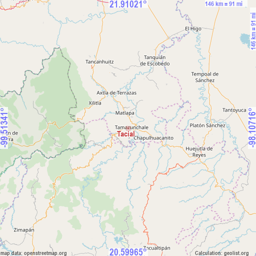
Tacial GPS coordinates[2]
21° 15' 23.004" North, 98° 48' 37.008" West
| Map corner | latitude | longitude |
|---|---|---|
| Upper-left | 21.91021°, | -99.51341° |
| Center: | 21.25639°, | -98.81028° |
| Lower-right: | 20.59965°, | -98.10716° |
| Map W x H: | 145.7×145.7 km | = 90.5×90.5mi |
| max Lat: | 32.7° ⇑20.3% North |
| Tacial: | 21.25639° |
| min Lat: | ⇓79.7% South 14.53588° |
| min Long | Tacial | max Long |
| -117.105° | -98.81028° | -86.73105° |
| W 53.4%⇐ | ⇒46.6% E |
Elevation
Elevation of Tacial is 139 m = 456 ft, and this is 1114.7 m = 3657 ft below average elevation for this country.
| Max E: |
3497 m = 11473 ft | 77.6% |
| Avg. | 1253.7 m = 4113 ft | |
| Tacial | 139 m = 456 ft | |
Min E: |
-1 m = -3 ft | 22.4% |
See also: Mexico elevation on elevation.city.
Geographical zone
Tacial is located in North Torrid zone (between Equator and Tropic of Cancer). Distance of this Northern Tropic circle is 242.4 km =150.6 mi to North.| Distance of | km | miles | from Tacial |
|---|---|---|---|
| North Pole | 7643.6 | 4749.5 | to North |
| Arctic Circle | 5037.7 | 3130.3 | to North |
| Tropic Cancer | 242.4 | 150.6 | to North |
| Equator | 2363.5 | 1468.6 | to South |


Nearby cities:
15 places around Tacial: (largest is in red/bold)
• Ahuehueyo
3.2 km =2 mi,  358°
358°
• Atlajque
4.8 km =3 mi,  172°
172°
• Coyol (Vega Larga)
4.6 km =2.9 mi,  284°
284°
• Huazalingo
4 km =2.5 mi,  251°
251°
• Ixteamel
3.3 km =2.1 mi,  25°
25°
• Ixtlapalaco
4.5 km =2.8 mi,  73°
73°
• Mecatlán
4.5 km =2.8 mi,  156°
156°
• Papatlaco Santiago
4.8 km =3 mi,  224°
224°
• Tamacol
2.9 km =1.8 mi,  212°
212°
• Tamazunchale
2.2 km =1.4 mi,  79°
79°
• Temamatla
5.6 km =3.5 mi,  115°
115°
• Tepetzintla
5.5 km =3.4 mi,  348°
348°
• Texquitote Primero
4.7 km =2.9 mi,  11°
11°
• Vega Larga
3 km =1.9 mi,  269°
269°
• Xaltipa
5.1 km =3.2 mi,  259°
259°
Sources, notices
• [Note1] Compared only with cities in Mexico existing in our database
• [Src1] Map data: © OpenStreetMap contributors (CC-BY-SA)
• [Src2] Other city data from geonames.org with taken over terms of usage.
• [Src3] Geographical zone / Annual Mean Temperature by Robert A. Rohde @ Wikipedia
