Temamatla geodata
Temamatla (San Luis Potosí) is a populated place; located in Mexico in America/Mexico_City (GMT-6) time zone. With population of 858 people, there are 10191 cities with bigger population in this country. Compared to other cities in Mexico, 79.5% of cities are located further ↓South; 54.2% of cities are located further ←West and 78.2% of cities have higher elevation than Temamatla. Note1


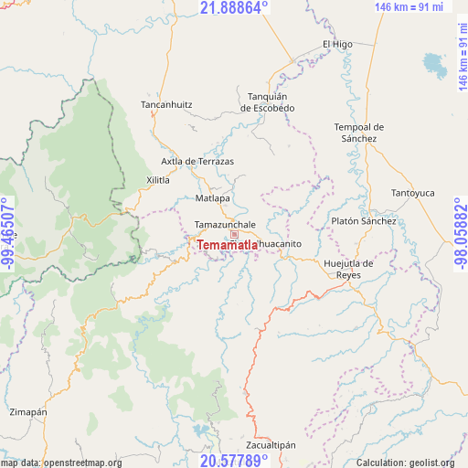
Temamatla GPS coordinates[2]
21° 14' 4.992" North, 98° 45' 42.984" West
| Map corner | latitude | longitude |
|---|---|---|
| Upper-left | 21.88864°, | -99.46507° |
| Center: | 21.23472°, | -98.76194° |
| Lower-right: | 20.57789°, | -98.05882° |
| Map W x H: | 145.7×145.7 km | = 90.5×90.5mi |
| max Lat: | 32.7° ⇑20.5% North |
| Temamatla: | 21.23472° |
| min Lat: | ⇓79.5% South 14.53588° |
| min Long | Temamatla | max Long |
| -117.105° | -98.76194° | -86.73105° |
| W 54.2%⇐ | ⇒45.8% E |
Elevation
Elevation of Temamatla is 126 m = 413 ft, and this is 1127.7 m = 3700 ft below average elevation for this country.
| Max E: |
3497 m = 11473 ft | 78.2% |
| Avg. | 1253.7 m = 4113 ft | |
| Temamatla | 126 m = 413 ft | |
Min E: |
-1 m = -3 ft | 21.8% |
See also: Mexico elevation on elevation.city.
Geographical zone
Temamatla is located in North Torrid zone (between Equator and Tropic of Cancer). Distance of this Northern Tropic circle is 244.8 km =152.1 mi to North.| Distance of | km | miles | from Temamatla |
|---|---|---|---|
| North Pole | 7646 | 4751 | to North |
| Arctic Circle | 5040.1 | 3131.8 | to North |
| Tropic Cancer | 244.8 | 152.1 | to North |
| Equator | 2361.1 | 1467.1 | to South |


Nearby cities:
15 places around Temamatla: (largest is in red/bold)
• Atlajque
5 km =3.1 mi,  242°
242°
• Axhumol
3.9 km =2.4 mi,  208°
208°
• Coaxocotitla
3 km =1.9 mi,  202°
202°
• Cojolapa
6 km =3.7 mi,  103°
103°
• El Palmito
5.8 km =3.6 mi,  73°
73°
• El Piñal
2.2 km =1.4 mi,  35°
35°
• Enramaditas
5.9 km =3.7 mi,  232°
232°
• Ixteamel
6.4 km =4 mi,  326°
326°
• Ixtlapalaco
3.8 km =2.4 mi,  349°
349°
• Mecatlán
3.6 km =2.2 mi, 242°
• Rancho Nuevo
5.3 km =3.3 mi,  136°
136°
• Santa María Picula
4.1 km =2.5 mi,  153°
153°
• Tacial
5.6 km =3.5 mi,  295°
295°
• Tamazunchale
4 km =2.5 mi,  314°
314°
• Xalcuatla
5.7 km =3.5 mi,  180°
180°
Sources, notices
• [Note1] Compared only with cities in Mexico existing in our database
• [Src1] Map data: © OpenStreetMap contributors (CC-BY-SA)
• [Src2] Other city data from geonames.org with taken over terms of usage.
• [Src3] Geographical zone / Annual Mean Temperature by Robert A. Rohde @ Wikipedia
