Llano Grande geodata
Llano Grande (Guerrero) is a populated place; located in Mexico in America/Mexico_City (GMT-6) time zone. With population of 686 people, there are 12663 cities with bigger population in this country. Compared to other cities in Mexico, 92.4% of cities are located further ↑North; 52.3% of cities are located further →East and 89% of cities have higher elevation than Llano Grande. Note1


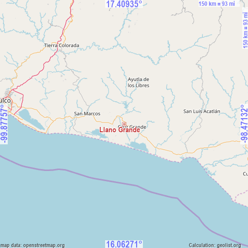
Llano Grande GPS coordinates[2]
16° 44' 13.992" North, 99° 10' 27.984" West
| Map corner | latitude | longitude |
|---|---|---|
| Upper-left | 17.40935°, | -99.87757° |
| Center: | 16.73722°, | -99.17444° |
| Lower-right: | 16.06271°, | -98.47132° |
| Map W x H: | 149.7×149.7 km | = 93×93mi |
| max Lat: | 32.7° ⇑92.4% North |
| Llano Grande: | 16.73722° |
| min Lat: | ⇓7.6% South 14.53588° |
| min Long | Llano Grande | max Long |
| -117.105° | -99.17444° | -86.73105° |
| W 47.7%⇐ | ⇒52.3% E |
Elevation
Elevation of Llano Grande is 27 m = 89 ft, and this is 1226.7 m = 4025 ft below average elevation for this country.
| Max E: |
3497 m = 11473 ft | 89% |
| Avg. | 1253.7 m = 4113 ft | |
| Llano Grande | 27 m = 89 ft | |
Min E: |
-1 m = -3 ft | 11% |
See also: Mexico elevation on elevation.city.
Geographical zone
Llano Grande is located in North Torrid zone (between Equator and Tropic of Cancer). Distance of this Northern Tropic circle is 744.9 km =462.9 mi to North.| Distance of | km | miles | from Llano Grande |
|---|---|---|---|
| North Pole | 8146.1 | 5061.8 | to North |
| Arctic Circle | 5540.2 | 3442.5 | to North |
| Tropic Cancer | 744.9 | 462.9 | to North |
| Equator | 1861 | 1156.4 | to South |


Nearby cities:
15 places around Llano Grande: (largest is in red/bold)
• Alto de Ventura
9.1 km =5.7 mi,  253°
253°
• Arroyo de Limón
11.3 km =7 mi,  309°
309°
• Chautengo
13.8 km =8.6 mi,  140°
140°
• Cruz Grande
5.7 km =3.5 mi,  106°
106°
• Cuatro Bancos
6.8 km =4.2 mi,  182°
182°
• El Porvenir
4.7 km =2.9 mi,  332°
332°
• El Zapote
14 km =8.7 mi,  38°
38°
• Estero Verde
8.4 km =5.2 mi,  216°
216°
• Jalapa
13 km =8.1 mi,  102°
102°
• La Azozuca
16.9 km =10.5 mi,  56°
56°
• La Unión
10.6 km =6.6 mi,  29°
29°
• Las Animas
9.1 km =5.7 mi,  198°
198°
• Las Peñas
16.8 km =10.4 mi,  133°
133°
• Las Vigas
6.4 km =4 mi,  294°
294°
• Pico del Monte
15.2 km =9.4 mi,  158°
158°
Sources, notices
• [Note1] Compared only with cities in Mexico existing in our database
• [Src1] Map data: © OpenStreetMap contributors (CC-BY-SA)
• [Src2] Other city data from geonames.org with taken over terms of usage.
• [Src3] Geographical zone / Annual Mean Temperature by Robert A. Rohde @ Wikipedia
