Arroyo de Limón geodata
Arroyo de Limón (Guerrero) is a populated place; located in Mexico in America/Mexico_City (GMT-6) time zone. With population of 510 people, there are 16480 cities with bigger population in this country. Compared to other cities in Mexico, 91.7% of cities are located further ↑North; 53.7% of cities are located further →East and 82.7% of cities have higher elevation than Arroyo de Limón. Note1


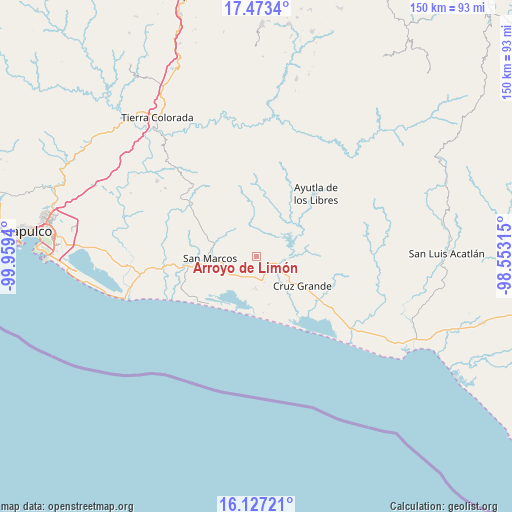
Arroyo de Limón GPS coordinates[2]
16° 48' 5.4" North, 99° 15' 22.572" West
| Map corner | latitude | longitude |
|---|---|---|
| Upper-left | 17.4734°, | -99.9594° |
| Center: | 16.8015°, | -99.25627° |
| Lower-right: | 16.12721°, | -98.55315° |
| Map W x H: | 149.7×149.7 km | = 93×93mi |
| max Lat: | 32.7° ⇑91.7% North |
| Arroyo de Limón: | 16.8015° |
| min Lat: | ⇓8.3% South 14.53588° |
| min Long | Arroyo de Limó | max Long |
| -117.105° | -99.25627° | -86.73105° |
| W 46.3%⇐ | ⇒53.7% E |
Elevation
Elevation of Arroyo de Limón is 63 m = 207 ft, and this is 1190.7 m = 3906 ft below average elevation for this country.
| Max E: |
3497 m = 11473 ft | 82.7% |
| Avg. | 1253.7 m = 4113 ft | |
| Arroyo de Limón | 63 m = 207 ft | |
Min E: |
-1 m = -3 ft | 17.3% |
See also: Mexico elevation on elevation.city.
Geographical zone
Arroyo de Limón is located in North Torrid zone (between Equator and Tropic of Cancer). Distance of this Northern Tropic circle is 737.8 km =458.4 mi to North.| Distance of | km | miles | from Arroyo de Limón |
|---|---|---|---|
| North Pole | 8138.9 | 5057.3 | to North |
| Arctic Circle | 5533 | 3438 | to North |
| Tropic Cancer | 737.8 | 458.4 | to North |
| Equator | 1868.2 | 1160.8 | to South |


Nearby cities:
15 places around Arroyo de Limón: (largest is in red/bold)
• Alto de Ventura
9.8 km =6.1 mi,  180°
180°
• El Amatal
10.3 km =6.4 mi,  324°
324°
• El Carrizo
14.1 km =8.8 mi,  15°
15°
• El Guayabo
16.2 km =10.1 mi, 18°
• El Porvenir
7.2 km =4.5 mi,  114°
114°
• El Tecorral
11.4 km =7.1 mi,  352°
352°
• Estero Verde
14.4 km =8.9 mi,  165°
165°
• La Unión
14.1 km =8.8 mi,  81°
81°
• Las Vigas
5.3 km =3.3 mi,  147°
147°
• Llano Grande
11.3 km =7 mi,  129°
129°
• Parota Seca
15.4 km =9.6 mi,  358°
358°
• Rancho Viejo
7.9 km =4.9 mi,  333°
333°
• San Marcos
14.2 km =8.8 mi,  268°
268°
• Santa Elena Guerrero
11.1 km =6.9 mi,  311°
311°
• Santa Elena de la Villa
10.5 km =6.5 mi, 318°
Sources, notices
• [Note1] Compared only with cities in Mexico existing in our database
• [Src1] Map data: © OpenStreetMap contributors (CC-BY-SA)
• [Src2] Other city data from geonames.org with taken over terms of usage.
• [Src3] Geographical zone / Annual Mean Temperature by Robert A. Rohde @ Wikipedia
