Perla de Acapulco geodata
Perla de Acapulco (Chiapas) is a populated place; located in Mexico in America/Mexico_City (GMT-6) time zone. With population of 1,527 people, there are 5651 cities with bigger population in this country. Compared to other cities in Mexico, 91.8% of cities are located further ↑North; 96.4% of cities are located further ←West and 65.8% of cities have higher elevation than Perla de Acapulco. Note1


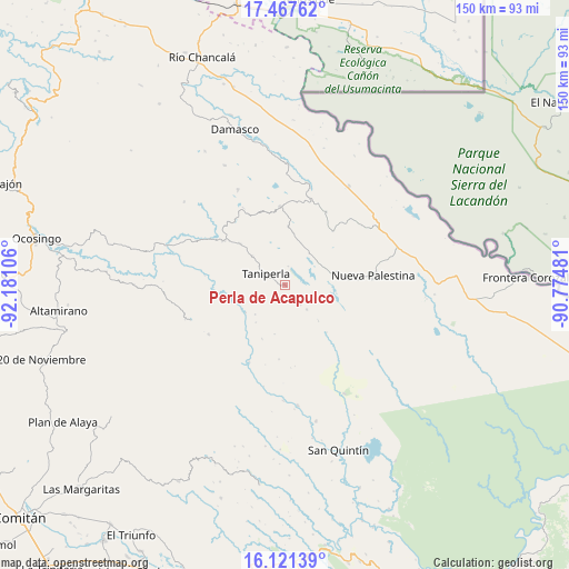
Perla de Acapulco GPS coordinates[2]
16° 47' 44.52" North, 91° 28' 40.548" West
| Map corner | latitude | longitude |
|---|---|---|
| Upper-left | 17.46762°, | -92.18106° |
| Center: | 16.7957°, | -91.47793° |
| Lower-right: | 16.12139°, | -90.77481° |
| Map W x H: | 149.7×149.7 km | = 93×93mi |
| max Lat: | 32.7° ⇑91.8% North |
| Perla de Acapulco: | 16.7957° |
| min Lat: | ⇓8.2% South 14.53588° |
| min Long | Perla de Acapul | max Long |
| -117.105° | -91.47793° | -86.73105° |
| W 96.4%⇐ | ⇒3.6% E |
Elevation
Elevation of Perla de Acapulco is 646 m = 2119 ft, and this is 607.7 m = 1994 ft below average elevation for this country.
| Max E: |
3497 m = 11473 ft | 65.8% |
| Avg. | 1253.7 m = 4113 ft | |
| Perla de Acapulco | 646 m = 2119 ft | |
Min E: |
-1 m = -3 ft | 34.2% |
See also: Mexico elevation on elevation.city.
Geographical zone
Perla de Acapulco is located in North Torrid zone (between Equator and Tropic of Cancer). Distance of this Northern Tropic circle is 738.4 km =458.8 mi to North.| Distance of | km | miles | from Perla de Acapulco |
|---|---|---|---|
| North Pole | 8139.6 | 5057.7 | to North |
| Arctic Circle | 5533.7 | 3438.5 | to North |
| Tropic Cancer | 738.4 | 458.8 | to North |
| Equator | 1867.5 | 1160.4 | to South |


Nearby cities:
15 places around Perla de Acapulco: (largest is in red/bold)
• Ach Lum Monte Líbano
19.6 km =12.2 mi,  306°
306°
• Agua Azul
5.3 km =3.3 mi,  292°
292°
• Cintalapa
18.9 km =11.7 mi,  41°
41°
• El Censo
11.5 km =7.1 mi, 310°
• El Jardín
20.2 km =12.6 mi,  343°
343°
• El Zapotal
6.4 km =4 mi,  143°
143°
• Las Tazas
15.2 km =9.4 mi,  253°
253°
• Plan de Ayutla
18.1 km =11.2 mi,  84°
84°
• Plácido Flores
20.3 km =12.6 mi,  304°
304°
• San Caralampio
8.5 km =5.3 mi, 138°
• San José
12.8 km =8 mi, 137°
• Santa Elena
16.1 km =10 mi, 312°
• Santa Rita
13.9 km =8.6 mi,  8°
8°
• Santo Tomás
11.2 km =7 mi,  225°
225°
• Taniperla
5.7 km =3.5 mi, 301°
Sources, notices
• [Note1] Compared only with cities in Mexico existing in our database
• [Src1] Map data: © OpenStreetMap contributors (CC-BY-SA)
• [Src2] Other city data from geonames.org with taken over terms of usage.
• [Src3] Geographical zone / Annual Mean Temperature by Robert A. Rohde @ Wikipedia
