Ahuacatlaya geodata
Ahuacatlaya (Puebla) is a populated place; located in Mexico in America/Mexico_City (GMT-6) time zone. With population of 552 people, there are 15449 cities with bigger population in this country. Compared to other cities in Mexico, 60.9% of cities are located further ↓South; 65.7% of cities are located further ←West and 63.4% of cities have higher elevation than Ahuacatlaya. Note1


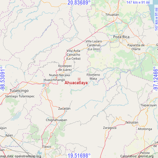
Ahuacatlaya GPS coordinates[2]
20° 10' 41.988" North, 97° 49' 40.008" West
| Map corner | latitude | longitude |
|---|---|---|
| Upper-left | 20.83689°, | -98.53091° |
| Center: | 20.17833°, | -97.82778° |
| Lower-right: | 19.51698°, | -97.12466° |
| Map W x H: | 146.8×146.8 km | = 91.2×91.2mi |
| max Lat: | 32.7° ⇑39.1% North |
| Ahuacatlaya: | 20.17833° |
| min Lat: | ⇓60.9% South 14.53588° |
| min Long | Ahuacatlaya | max Long |
| -117.105° | -97.82778° | -86.73105° |
| W 65.7%⇐ | ⇒34.3% E |
Elevation
Elevation of Ahuacatlaya is 790 m = 2592 ft, and this is 463.7 m = 1521 ft below average elevation for this country.
| Max E: |
3497 m = 11473 ft | 63.4% |
| Avg. | 1253.7 m = 4113 ft | |
| Ahuacatlaya | 790 m = 2592 ft | |
Min E: |
-1 m = -3 ft | 36.6% |
See also: Mexico elevation on elevation.city.
Geographical zone
Ahuacatlaya is located in North Torrid zone (between Equator and Tropic of Cancer). Distance of this Northern Tropic circle is 362.3 km =225.1 mi to North.| Distance of | km | miles | from Ahuacatlaya |
|---|---|---|---|
| North Pole | 7763.4 | 4824 | to North |
| Arctic Circle | 5157.6 | 3204.8 | to North |
| Tropic Cancer | 362.3 | 225.1 | to North |
| Equator | 2243.6 | 1394.1 | to South |


Nearby cities:
15 places around Ahuacatlaya: (largest is in red/bold)
• Chicontla
7.3 km =4.5 mi,  357°
357°
• Cinco de Octubre
7.8 km =4.8 mi,  343°
343°
• El Encinal
5.3 km =3.3 mi, 335°
• La Cruz
4.9 km =3 mi,  168°
168°
• La Cumbre
7.1 km =4.4 mi,  202°
202°
• Patla
8.2 km =5.1 mi, 341°
• San Martín del Progreso (La Punta)
7.8 km =4.8 mi,  140°
140°
• San Pedro Tlaolantongo
6.5 km =4 mi,  24°
24°
• Tecpatlán
8 km =5 mi,  328°
328°
• Tlaltepango
6.3 km =3.9 mi,  234°
234°
• Tlamaya Chico
4.8 km =3 mi,  181°
181°
• Tlamaya Grande
4.3 km =2.7 mi, 143°
• Tlapacoya
6.6 km =4.1 mi, 201°
• Xochinanacatlán
7.5 km =4.7 mi,  284°
284°
• África
7.6 km =4.7 mi,  125°
125°
Sources, notices
• [Note1] Compared only with cities in Mexico existing in our database
• [Src1] Map data: © OpenStreetMap contributors (CC-BY-SA)
• [Src2] Other city data from geonames.org with taken over terms of usage.
• [Src3] Geographical zone / Annual Mean Temperature by Robert A. Rohde @ Wikipedia
