Tlamaya Grande geodata
Tlamaya Grande (Puebla) is a populated place; located in Mexico in America/Mexico_City (GMT-6) time zone. With population of 1,008 people, there are 8648 cities with bigger population in this country. Compared to other cities in Mexico, 60.2% of cities are located further ↓South; 66% of cities are located further ←West and 64.3% of cities have higher elevation than Tlamaya Grande. Note1


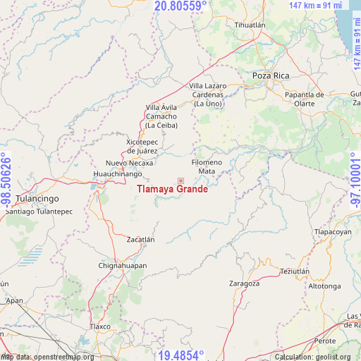
Tlamaya Grande GPS coordinates[2]
20° 8' 48.804" North, 97° 48' 11.268" West
| Map corner | latitude | longitude |
|---|---|---|
| Upper-left | 20.80559°, | -98.50626° |
| Center: | 20.14689°, | -97.80313° |
| Lower-right: | 19.4854°, | -97.10001° |
| Map W x H: | 146.8×146.8 km | = 91.2×91.2mi |
| max Lat: | 32.7° ⇑39.8% North |
| Tlamaya Grande: | 20.14689° |
| min Lat: | ⇓60.2% South 14.53588° |
| min Long | Tlamaya Grande | max Long |
| -117.105° | -97.80313° | -86.73105° |
| W 66%⇐ | ⇒34% E |
Elevation
Elevation of Tlamaya Grande is 734 m = 2408 ft, and this is 519.7 m = 1705 ft below average elevation for this country.
| Max E: |
3497 m = 11473 ft | 64.3% |
| Avg. | 1253.7 m = 4113 ft | |
| Tlamaya Grande | 734 m = 2408 ft | |
Min E: |
-1 m = -3 ft | 35.7% |
See also: Mexico elevation on elevation.city.
Geographical zone
Tlamaya Grande is located in North Torrid zone (between Equator and Tropic of Cancer). Distance of this Northern Tropic circle is 365.8 km =227.3 mi to North.| Distance of | km | miles | from Tlamaya Grande |
|---|---|---|---|
| North Pole | 7766.9 | 4826.1 | to North |
| Arctic Circle | 5161 | 3206.9 | to North |
| Tropic Cancer | 365.8 | 227.3 | to North |
| Equator | 2240.1 | 1391.9 | to South |


Nearby cities:
15 places around Tlamaya Grande: (largest is in red/bold)
• Ahuacatlaya
4.3 km =2.7 mi,  323°
323°
• Altica
6.6 km =4.1 mi,  178°
178°
• Bienvenido
6.7 km =4.2 mi,  113°
113°
• Buenos Aires
5.8 km =3.6 mi,  82°
82°
• Coyay
8.6 km =5.3 mi,  144°
144°
• Cuautotola
8.7 km =5.4 mi, 176°
• Ignacio Ramírez
8.5 km =5.3 mi,  117°
117°
• Jojupango (San Miguel Jojupango)
6.5 km =4 mi,  150°
150°
• La Cruz
2 km =1.2 mi,  231°
231°
• La Cumbre
6.1 km =3.8 mi,  240°
240°
• San Martín del Progreso (La Punta)
3.5 km =2.2 mi, 135°
• Tlaltepango
7.7 km =4.8 mi,  268°
268°
• Tlamaya Chico
3 km =1.9 mi, 243°
• Tlapacoya
5.6 km =3.5 mi, 241°
• África
3.8 km =2.4 mi,  103°
103°
Sources, notices
• [Note1] Compared only with cities in Mexico existing in our database
• [Src1] Map data: © OpenStreetMap contributors (CC-BY-SA)
• [Src2] Other city data from geonames.org with taken over terms of usage.
• [Src3] Geographical zone / Annual Mean Temperature by Robert A. Rohde @ Wikipedia
