Tirio geodata
Tirio (Michoacán) is a populated place; located in Mexico in America/Mexico_City (GMT-6) time zone. With population of 634 people, there are 13664 cities with bigger population in this country. Compared to other cities in Mexico, 52.8% of cities are located further ↑North; 75.5% of cities are located further →East and 77% of cities have lower elevation than Tirio. Note1


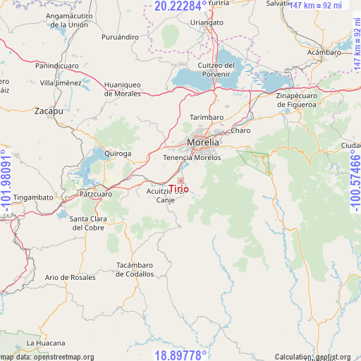
Tirio GPS coordinates[2]
19° 33' 42.012" North, 101° 16' 40.008" West
| Map corner | latitude | longitude |
|---|---|---|
| Upper-left | 20.22284°, | -101.98091° |
| Center: | 19.56167°, | -101.27778° |
| Lower-right: | 18.89778°, | -100.57466° |
| Map W x H: | 147.3×147.3 km | = 91.5×91.5mi |
| max Lat: | 32.7° ⇑52.8% North |
| Tirio: | 19.56167° |
| min Lat: | ⇓47.2% South 14.53588° |
| min Long | Tirio | max Long |
| -117.105° | -101.27778° | -86.73105° |
| W 24.5%⇐ | ⇒75.5% E |
Elevation
Elevation of Tirio is 2068 m = 6785 ft, and this is 814.3 m = 2672 ft above average elevation for this country.
| Max E: |
3497 m = 11473 ft | 23% |
| Tirio | 2068 m 6785 ft | |
| Avg. | 1253.7 m = 4113 ft | |
Min E: |
-1 m = -3 ft | 77% |
See also: Mexico elevation on elevation.city.
Geographical zone
Tirio is located in North Torrid zone (between Equator and Tropic of Cancer). Distance of this Northern Tropic circle is 430.9 km =267.7 mi to North.| Distance of | km | miles | from Tirio |
|---|---|---|---|
| North Pole | 7832 | 4866.6 | to North |
| Arctic Circle | 5226.1 | 3247.3 | to North |
| Tropic Cancer | 430.9 | 267.7 | to North |
| Equator | 2175.1 | 1351.5 | to South |


Nearby cities:
15 places around Tirio: (largest is in red/bold)
• Acuítzio del Canje
9.3 km =5.8 mi,  218°
218°
• Coíntzio
8.9 km =5.5 mi,  10°
10°
• El Cerrito Itzícuaro
12 km =7.5 mi,  359°
359°
• Estación Jácuaro (Colonia la Reunión)
4.1 km =2.5 mi,  339°
339°
• La Estancia
4.3 km =2.7 mi,  313°
313°
• La Mintzita (Piedra Dura)
10 km =6.2 mi,  0°
0°
• Morelos
10.5 km =6.5 mi,  22°
22°
• San Antonio
11.8 km =7.3 mi, 4°
• San Antonio Parangare
9.5 km =5.9 mi,  350°
350°
• San José Coapa
11.4 km =7.1 mi,  267°
267°
• San Nicolás Obispo
10.9 km =6.8 mi, 338°
• San Rafael Coapa
9.7 km =6 mi,  246°
246°
• Santiago Undameo
3.8 km =2.4 mi, 348°
• Tirípetio
7.4 km =4.6 mi,  258°
258°
• Uruapilla
6.4 km =4 mi, 359°
Sources, notices
• [Note1] Compared only with cities in Mexico existing in our database
• [Src1] Map data: © OpenStreetMap contributors (CC-BY-SA)
• [Src2] Other city data from geonames.org with taken over terms of usage.
• [Src3] Geographical zone / Annual Mean Temperature by Robert A. Rohde @ Wikipedia
