San Rafael Coapa geodata
San Rafael Coapa (Michoacán) is a populated place; located in Mexico in America/Mexico_City (GMT-6) time zone. With population of 815 people, there are 10718 cities with bigger population in this country. Compared to other cities in Mexico, 53.6% of cities are located further ↑North; 76.2% of cities are located further →East and 75.9% of cities have lower elevation than San Rafael Coapa. Note1


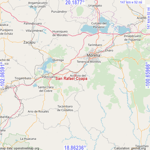
San Rafael Coapa GPS coordinates[2]
19° 31' 35.004" North, 101° 21' 46.008" West
| Map corner | latitude | longitude |
|---|---|---|
| Upper-left | 20.1877°, | -102.06591° |
| Center: | 19.52639°, | -101.36278° |
| Lower-right: | 18.86236°, | -100.65966° |
| Map W x H: | 147.4×147.4 km | = 91.6×91.6mi |
| max Lat: | 32.7° ⇑53.6% North |
| San Rafael Coapa: | 19.52639° |
| min Lat: | ⇓46.4% South 14.53588° |
| min Long | San Rafael Coap | max Long |
| -117.105° | -101.36278° | -86.73105° |
| W 23.8%⇐ | ⇒76.2% E |
Elevation
Elevation of San Rafael Coapa is 2047 m = 6716 ft, and this is 793.3 m = 2603 ft above average elevation for this country.
| Max E: |
3497 m = 11473 ft | 24.1% |
| San Rafael Coapa | 2047 m 6716 ft | |
| Avg. | 1253.7 m = 4113 ft | |
Min E: |
-1 m = -3 ft | 75.9% |
See also: Mexico elevation on elevation.city.
Geographical zone
San Rafael Coapa is located in North Torrid zone (between Equator and Tropic of Cancer). Distance of this Northern Tropic circle is 434.8 km =270.2 mi to North.| Distance of | km | miles | from San Rafael Coapa |
|---|---|---|---|
| North Pole | 7835.9 | 4869 | to North |
| Arctic Circle | 5230 | 3249.8 | to North |
| Tropic Cancer | 434.8 | 270.2 | to North |
| Equator | 2171.1 | 1349.1 | to South |


Nearby cities:
15 places around San Rafael Coapa: (largest is in red/bold)
• Acuítzio del Canje
4.6 km =2.9 mi,  137°
137°
• Chihuerio
5.8 km =3.6 mi,  215°
215°
• Cutzaro
9.2 km =5.7 mi,  161°
161°
• El Pedregal
9.2 km =5.7 mi,  259°
259°
• El Sobrado
10.6 km =6.6 mi, 262°
• Estación Jácuaro (Colonia la Reunión)
10.7 km =6.6 mi,  44°
44°
• Huiramba
8 km =5 mi,  285°
285°
• La Caja
10 km =6.2 mi,  312°
312°
• La Estancia
9 km =5.6 mi, 40°
• Lagunillas
6.9 km =4.3 mi, 306°
• Las Tablas
8.7 km =5.4 mi,  251°
251°
• San Andrés Coapa
3.8 km =2.4 mi,  213°
213°
• San José Coapa
4.3 km =2.7 mi,  324°
324°
• Tirio
9.7 km =6 mi,  66°
66°
• Tirípetio
3 km =1.9 mi,  33°
33°
Sources, notices
• [Note1] Compared only with cities in Mexico existing in our database
• [Src1] Map data: © OpenStreetMap contributors (CC-BY-SA)
• [Src2] Other city data from geonames.org with taken over terms of usage.
• [Src3] Geographical zone / Annual Mean Temperature by Robert A. Rohde @ Wikipedia
