Chabán geodata
Chabán (Chiapas) is a populated place; located in Mexico in America/Mexico_City (GMT-6) time zone. With population of 619 people, there are 13941 cities with bigger population in this country. Compared to other cities in Mexico, 86.4% of cities are located further ↑North; 94.7% of cities are located further ←West and 71.3% of cities have higher elevation than Chabán. Note1


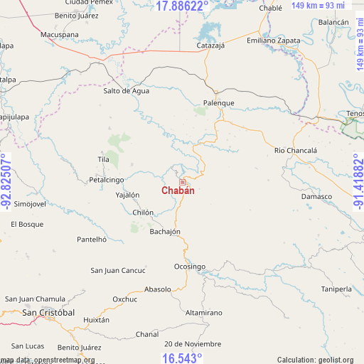
Chabán GPS coordinates[2]
17° 12' 56.988" North, 92° 7' 18.984" West
| Map corner | latitude | longitude |
|---|---|---|
| Upper-left | 17.88622°, | -92.82507° |
| Center: | 17.21583°, | -92.12194° |
| Lower-right: | 16.543°, | -91.41882° |
| Map W x H: | 149.4×149.4 km | = 92.8×92.8mi |
| max Lat: | 32.7° ⇑86.4% North |
| Chabán: | 17.21583° |
| min Lat: | ⇓13.6% South 14.53588° |
| min Long | Chabán | max Long |
| -117.105° | -92.12194° | -86.73105° |
| W 94.7%⇐ | ⇒5.3% E |
Elevation
Elevation of Chabán is 358 m = 1175 ft, and this is 895.7 m = 2939 ft below average elevation for this country.
| Max E: |
3497 m = 11473 ft | 71.3% |
| Avg. | 1253.7 m = 4113 ft | |
| Chabán | 358 m = 1175 ft | |
Min E: |
-1 m = -3 ft | 28.7% |
See also: Mexico elevation on elevation.city.
Geographical zone
Chabán is located in North Torrid zone (between Equator and Tropic of Cancer). Distance of this Northern Tropic circle is 691.7 km =429.8 mi to North.| Distance of | km | miles | from Chabán |
|---|---|---|---|
| North Pole | 8092.8 | 5028.6 | to North |
| Arctic Circle | 5487 | 3409.5 | to North |
| Tropic Cancer | 691.7 | 429.8 | to North |
| Equator | 1914.2 | 1189.4 | to South |


Nearby cities:
15 places around Chabán: (largest is in red/bold)
• Centro Chich
6 km =3.7 mi,  212°
212°
• Corostic
10.7 km =6.6 mi,  201°
201°
• Cuctiepa
11.7 km =7.3 mi,  329°
329°
• El Mango
8.9 km =5.5 mi,  132°
132°
• Ignacio Allende
4.8 km =3 mi,  323°
323°
• José María Morelos y Pavón
11.8 km =7.3 mi,  303°
303°
• La Esperanza Mórrizon
9.5 km =5.9 mi, 296°
• Pactiún
12.5 km =7.8 mi, 296°
• Patatehel
6.9 km =4.3 mi,  224°
224°
• Patelná
6.1 km =3.8 mi, 295°
• Río Tulija
12 km =7.5 mi,  41°
41°
• Suluphuitz
10 km =6.2 mi,  260°
260°
• Venustiano Carranza
11 km =6.8 mi, 330°
• Vicente Guerrero
12.9 km =8 mi, 35°
• Xaxajatic
8.2 km =5.1 mi, 206°
Sources, notices
• [Note1] Compared only with cities in Mexico existing in our database
• [Src1] Map data: © OpenStreetMap contributors (CC-BY-SA)
• [Src2] Other city data from geonames.org with taken over terms of usage.
• [Src3] Geographical zone / Annual Mean Temperature by Robert A. Rohde @ Wikipedia
