Venustiano Carranza geodata
Venustiano Carranza (Chiapas) is a populated place; located in Mexico in America/Mexico_City (GMT-6) time zone. With population of 834 people, there are 10487 cities with bigger population in this country. Compared to other cities in Mexico, 85.2% of cities are located further ↑North; 94.3% of cities are located further ←West and 75.5% of cities have higher elevation than Venustiano Carranza. Note1


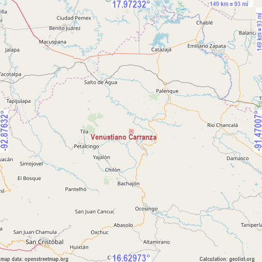
Venustiano Carranza GPS coordinates[2]
17° 18' 8.1" North, 92° 10' 23.484" West
| Map corner | latitude | longitude |
|---|---|---|
| Upper-left | 17.97232°, | -92.87632° |
| Center: | 17.30225°, | -92.17319° |
| Lower-right: | 16.62973°, | -91.47007° |
| Map W x H: | 149.3×149.3 km | = 92.8×92.8mi |
| max Lat: | 32.7° ⇑85.2% North |
| Venustiano Carranza: | 17.30225° |
| min Lat: | ⇓14.8% South 14.53588° |
| min Long | Venustiano Carr | max Long |
| -117.105° | -92.17319° | -86.73105° |
| W 94.3%⇐ | ⇒5.7% E |
Elevation
Elevation of Venustiano Carranza is 204 m = 669 ft, and this is 1049.7 m = 3444 ft below average elevation for this country.
| Max E: |
3497 m = 11473 ft | 75.5% |
| Avg. | 1253.7 m = 4113 ft | |
| Venustiano Carranza | 204 m = 669 ft | |
Min E: |
-1 m = -3 ft | 24.5% |
See also: Mexico elevation on elevation.city.
Geographical zone
Venustiano Carranza is located in North Torrid zone (between Equator and Tropic of Cancer). Distance of this Northern Tropic circle is 682.1 km =423.8 mi to North.| Distance of | km | miles | from Venustiano Carranza |
|---|---|---|---|
| North Pole | 8083.2 | 5022.7 | to North |
| Arctic Circle | 5477.3 | 3403.4 | to North |
| Tropic Cancer | 682.1 | 423.8 | to North |
| Equator | 1923.8 | 1195.4 | to South |


Nearby cities:
15 places around Venustiano Carranza: (largest is in red/bold)
• Amado Nervo
11 km =6.8 mi,  224°
224°
• Benito Juárez
10.1 km =6.3 mi,  240°
240°
• Cacahuatal
6 km =3.7 mi,  291°
291°
• Chabán
11 km =6.8 mi,  150°
150°
• Chuchucruz Primera Sección
10.3 km =6.4 mi,  271°
271°
• Cuctiepa
0.7 km =0.4 mi,  322°
322°
• Ignacio Allende
6.4 km =4 mi,  156°
156°
• José María Morelos y Pavón
5.4 km =3.4 mi,  234°
234°
• La Esperanza Mórrizon
6.2 km =3.9 mi,  209°
209°
• Pactiún
7.1 km =4.4 mi, 234°
• Patelná
7 km =4.3 mi,  180°
180°
• San Pedro
11.3 km =7 mi,  337°
337°
• Santa María
11.6 km =7.2 mi,  61°
61°
• Suluphuitz
12.1 km =7.5 mi,  201°
201°
• Tioquipa el Bascán
9.7 km =6 mi,  19°
19°
Sources, notices
• [Note1] Compared only with cities in Mexico existing in our database
• [Src1] Map data: © OpenStreetMap contributors (CC-BY-SA)
• [Src2] Other city data from geonames.org with taken over terms of usage.
• [Src3] Geographical zone / Annual Mean Temperature by Robert A. Rohde @ Wikipedia
