El Salitre geodata
El Salitre (Michoacán) is a populated place; located in Mexico in America/Mexico_City (GMT-6) time zone. With population of 614 people, there are 14035 cities with bigger population in this country. Compared to other cities in Mexico, 55% of cities are located further ↓South; 75.8% of cities are located further →East and 65.6% of cities have lower elevation than El Salitre. Note1


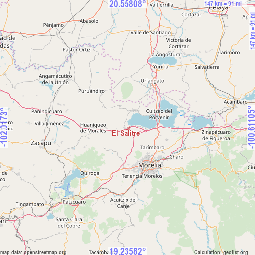
El Salitre GPS coordinates[2]
19° 53' 53.988" North, 101° 18' 51.012" West
| Map corner | latitude | longitude |
|---|---|---|
| Upper-left | 20.55808°, | -102.0173° |
| Center: | 19.89833°, | -101.31417° |
| Lower-right: | 19.23582°, | -100.61105° |
| Map W x H: | 147×147 km | = 91.3×91.3mi |
| max Lat: | 32.7° ⇑45% North |
| El Salitre: | 19.89833° |
| min Lat: | ⇓55% South 14.53588° |
| min Long | El Salitre | max Long |
| -117.105° | -101.31417° | -86.73105° |
| W 24.2%⇐ | ⇒75.8% E |
Elevation
Elevation of El Salitre is 1843 m = 6047 ft, and this is 589.3 m = 1933 ft above average elevation for this country.
| Max E: |
3497 m = 11473 ft | 34.4% |
| El Salitre | 1843 m 6047 ft | |
| Avg. | 1253.7 m = 4113 ft | |
Min E: |
-1 m = -3 ft | 65.6% |
See also: Mexico elevation on elevation.city.
Geographical zone
El Salitre is located in North Torrid zone (between Equator and Tropic of Cancer). Distance of this Northern Tropic circle is 393.4 km =244.4 mi to North.| Distance of | km | miles | from El Salitre |
|---|---|---|---|
| North Pole | 7794.6 | 4843.3 | to North |
| Arctic Circle | 5188.7 | 3224.1 | to North |
| Tropic Cancer | 393.4 | 244.4 | to North |
| Equator | 2212.5 | 1374.8 | to South |


Nearby cities:
15 places around El Salitre: (largest is in red/bold)
• Arumbaro
12.5 km =7.8 mi,  98°
98°
• Capacho
11.4 km =7.1 mi,  49°
49°
• Cañada de la Yerbabuena
11.7 km =7.3 mi,  107°
107°
• Cañada de los Sauces
12.7 km =7.9 mi,  125°
125°
• Chiquimitío
13.2 km =8.2 mi,  150°
150°
• Chucándiro
2.1 km =1.3 mi,  275°
275°
• Copándaro de Galeana
10.5 km =6.5 mi,  93°
93°
• Cotzurio
10 km =6.2 mi,  170°
170°
• El Nispo
9.4 km =5.8 mi, 97°
• Huandacareo
11.1 km =6.9 mi,  21°
21°
• La Estancia
8.9 km =5.5 mi,  6°
6°
• San José Cuaro
11.9 km =7.4 mi,  33°
33°
• San Nicolás Tumbastatiro (Cañada de Abajo)
11.3 km =7 mi,  344°
344°
• Santa Rita
5.5 km =3.4 mi,  82°
82°
• Tendeparacua
12.4 km =7.7 mi,  269°
269°
Sources, notices
• [Note1] Compared only with cities in Mexico existing in our database
• [Src1] Map data: © OpenStreetMap contributors (CC-BY-SA)
• [Src2] Other city data from geonames.org with taken over terms of usage.
• [Src3] Geographical zone / Annual Mean Temperature by Robert A. Rohde @ Wikipedia
