Santa Ana geodata
Santa Ana (Veracruz) is a populated place; located in Mexico in America/Mexico_City (GMT-6) time zone. With population of 894 people, there are 9757 cities with bigger population in this country. Compared to other cities in Mexico, 54.9% of cities are located further ↓South; 79.7% of cities are located further ←West and 95.7% of cities have higher elevation than Santa Ana. Note1


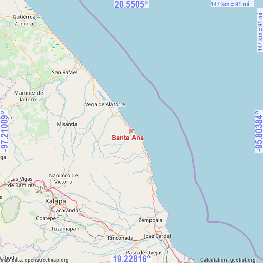
Santa Ana GPS coordinates[2]
19° 53' 26.556" North, 96° 30' 25.056" West
| Map corner | latitude | longitude |
|---|---|---|
| Upper-left | 20.5505°, | -97.21009° |
| Center: | 19.89071°, | -96.50696° |
| Lower-right: | 19.22816°, | -95.80384° |
| Map W x H: | 147×147 km | = 91.3×91.3mi |
| max Lat: | 32.7° ⇑45.1% North |
| Santa Ana: | 19.89071° |
| min Lat: | ⇓54.9% South 14.53588° |
| min Long | Santa Ana | max Long |
| -117.105° | -96.50696° | -86.73105° |
| W 79.7%⇐ | ⇒20.3% E |
Elevation
Elevation of Santa Ana is 12 m = 39 ft, and this is 1241.7 m = 4074 ft below average elevation for this country.
| Max E: |
3497 m = 11473 ft | 95.7% |
| Avg. | 1253.7 m = 4113 ft | |
| Santa Ana | 12 m = 39 ft | |
Min E: |
-1 m = -3 ft | 4.3% |
See also: Mexico elevation on elevation.city.
Geographical zone
Santa Ana is located in North Torrid zone (between Equator and Tropic of Cancer). Distance of this Northern Tropic circle is 394.3 km =245 mi to North.| Distance of | km | miles | from Santa Ana |
|---|---|---|---|
| North Pole | 7795.4 | 4843.8 | to North |
| Arctic Circle | 5189.5 | 3224.6 | to North |
| Tropic Cancer | 394.3 | 245 | to North |
| Equator | 2211.6 | 1374.2 | to South |


Nearby cities:
15 places around Santa Ana: (largest is in red/bold)
• Colipa
23.3 km =14.5 mi,  278°
278°
• Cristóbal Hidalgo
26.6 km =16.5 mi,  260°
260°
• Cuautitlán del Parral
24.1 km =15 mi, 257°
• Dos Arroyos
21.2 km =13.2 mi, 262°
• El Chaparral
15.2 km =9.4 mi, 261°
• El Viejón Nuevo
24.6 km =15.3 mi,  155°
155°
• Juchique de Ferrer
20.4 km =12.7 mi,  253°
253°
• Laguna de Farfán
17.3 km =10.7 mi,  235°
235°
• Las Higueras
20.2 km =12.6 mi,  323°
323°
• Palma Sola
15.4 km =9.6 mi,  149°
149°
• Plan de las Hayas
22.9 km =14.2 mi,  230°
230°
• Rancho Nuevo
25 km =15.5 mi,  224°
224°
• Tierra Blanca
25.9 km =16.1 mi, 222°
• Vega de Alatorre
21.2 km =13.2 mi, 316°
• Villa Emilio Carranza
14.1 km =8.8 mi,  308°
308°
Sources, notices
• [Note1] Compared only with cities in Mexico existing in our database
• [Src1] Map data: © OpenStreetMap contributors (CC-BY-SA)
• [Src2] Other city data from geonames.org with taken over terms of usage.
• [Src3] Geographical zone / Annual Mean Temperature by Robert A. Rohde @ Wikipedia
