Tlalixtlahuacán geodata
Tlalixtlahuacán (Guerrero) is a populated place; located in Mexico in America/Mexico_City (GMT-6) time zone. With population of 589 people, there are 14579 cities with bigger population in this country. Compared to other cities in Mexico, 83.3% of cities are located further ↑North; 51.4% of cities are located further →East and 56.9% of cities have lower elevation than Tlalixtlahuacán. Note1


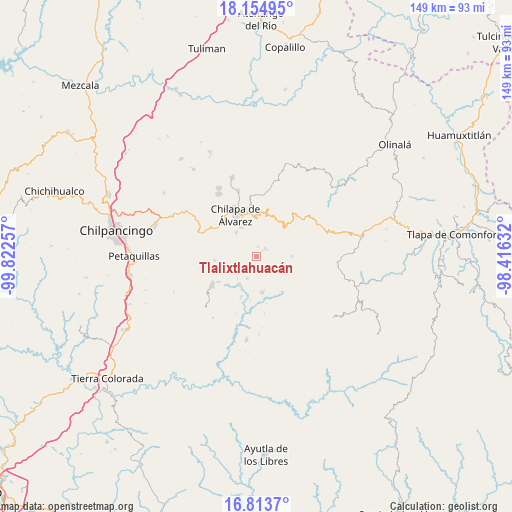
Tlalixtlahuacán GPS coordinates[2]
17° 29' 8.016" North, 99° 7' 9.984" West
| Map corner | latitude | longitude |
|---|---|---|
| Upper-left | 18.15495°, | -99.82257° |
| Center: | 17.48556°, | -99.11944° |
| Lower-right: | 16.8137°, | -98.41632° |
| Map W x H: | 149.1×149.1 km | = 92.6×92.6mi |
| max Lat: | 32.7° ⇑83.3% North |
| Tlalixtlahuacán: | 17.48556° |
| min Lat: | ⇓16.7% South 14.53588° |
| min Long | Tlalixtlahuacá | max Long |
| -117.105° | -99.11944° | -86.73105° |
| W 48.6%⇐ | ⇒51.4% E |
Elevation
Elevation of Tlalixtlahuacán is 1654 m = 5427 ft, and this is 400.3 m = 1313 ft above average elevation for this country.
| Max E: |
3497 m = 11473 ft | 43.1% |
| Tlalixtlahuacán | 1654 m 5427 ft | |
| Avg. | 1253.7 m = 4113 ft | |
Min E: |
-1 m = -3 ft | 56.9% |
See also: Mexico elevation on elevation.city.
Geographical zone
Tlalixtlahuacán is located in North Torrid zone (between Equator and Tropic of Cancer). Distance of this Northern Tropic circle is 661.7 km =411.2 mi to North.| Distance of | km | miles | from Tlalixtlahuacán |
|---|---|---|---|
| North Pole | 8062.8 | 5010 | to North |
| Arctic Circle | 5457 | 3390.8 | to North |
| Tropic Cancer | 661.7 | 411.2 | to North |
| Equator | 1944.2 | 1208.1 | to South |


Nearby cities:
15 places around Tlalixtlahuacán: (largest is in red/bold)
• Acalco
5.5 km =3.4 mi,  294°
294°
• Alcozacán
3.3 km =2.1 mi,  50°
50°
• Atenxoxola
2.5 km =1.6 mi,  276°
276°
• Atzacoaloya
7.1 km =4.4 mi,  344°
344°
• Ayahualulco
6.9 km =4.3 mi, 284°
• El Jagüey
2.9 km =1.8 mi, 280°
• Juxtlahuaca
6.9 km =4.3 mi,  204°
204°
• San Jerónimo Palantla
5.8 km =3.6 mi,  34°
34°
• San Ángel
4.9 km =3 mi,  265°
265°
• Tlanipatla
6 km =3.7 mi,  332°
332°
• Xiloxuchicán
4.3 km =2.7 mi,  251°
251°
• Xochitempa
7.1 km =4.4 mi,  311°
311°
• Zelocotitlán
4.6 km =2.9 mi,  162°
162°
• Zinzintitlán
6.8 km =4.2 mi, 328°
• Zizicazapa
4.8 km =3 mi, 313°
Sources, notices
• [Note1] Compared only with cities in Mexico existing in our database
• [Src1] Map data: © OpenStreetMap contributors (CC-BY-SA)
• [Src2] Other city data from geonames.org with taken over terms of usage.
• [Src3] Geographical zone / Annual Mean Temperature by Robert A. Rohde @ Wikipedia
