Xibtla geodata
Xibtla (Veracruz) is a populated place; located in Mexico in America/Mexico_City (GMT-6) time zone. With population of 576 people, there are 14877 cities with bigger population in this country. Compared to other cities in Mexico, 70.5% of cities are located further ↑North; 73.9% of cities are located further ←West and 80.5% of cities have lower elevation than Xibtla. Note1


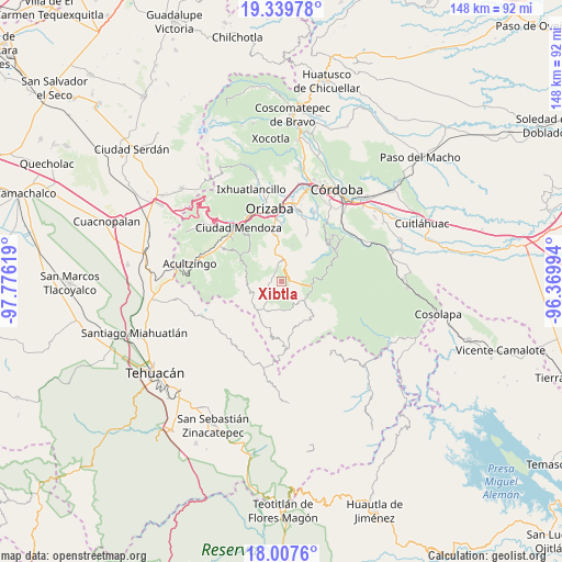
Xibtla GPS coordinates[2]
18° 40' 30" North, 97° 4' 23.016" West
| Map corner | latitude | longitude |
|---|---|---|
| Upper-left | 19.33978°, | -97.77619° |
| Center: | 18.675°, | -97.07306° |
| Lower-right: | 18.0076°, | -96.36994° |
| Map W x H: | 148.1×148.1 km | = 92×92mi |
| max Lat: | 32.7° ⇑70.5% North |
| Xibtla: | 18.675° |
| min Lat: | ⇓29.5% South 14.53588° |
| min Long | Xibtla | max Long |
| -117.105° | -97.07306° | -86.73105° |
| W 73.9%⇐ | ⇒26.1% E |
Elevation
Elevation of Xibtla is 2154 m = 7067 ft, and this is 900.3 m = 2954 ft above average elevation for this country.
| Max E: |
3497 m = 11473 ft | 19.5% |
| Xibtla | 2154 m 7067 ft | |
| Avg. | 1253.7 m = 4113 ft | |
Min E: |
-1 m = -3 ft | 80.5% |
See also: Mexico elevation on elevation.city.
Geographical zone
Xibtla is located in North Torrid zone (between Equator and Tropic of Cancer). Distance of this Northern Tropic circle is 529.5 km =329 mi to North.| Distance of | km | miles | from Xibtla |
|---|---|---|---|
| North Pole | 7930.6 | 4927.8 | to North |
| Arctic Circle | 5324.7 | 3308.6 | to North |
| Tropic Cancer | 529.5 | 329 | to North |
| Equator | 2076.5 | 1290.3 | to South |


Nearby cities:
15 places around Xibtla: (largest is in red/bold)
• Atlahuilco
3.1 km =1.9 mi,  321°
321°
• Atlanca
3.3 km =2.1 mi,  35°
35°
• Los Reyes
3.2 km =2 mi,  98°
98°
• Oxtotitla
8.8 km =5.5 mi,  51°
51°
• Santa Cruz
6 km =3.7 mi,  355°
355°
• Tepetitlanapa
7.2 km =4.5 mi,  119°
119°
• Tequila
6.1 km =3.8 mi,  3°
3°
• Texhuacán
6.8 km =4.2 mi,  149°
149°
• Tlalca
6.6 km =4.1 mi, 153°
• Tlaquilpa
8.7 km =5.4 mi,  213°
213°
• Tlilcalco
8.2 km =5.1 mi,  240°
240°
• Tolapa
7.3 km =4.5 mi,  351°
351°
• Xoxocotla
8.9 km =5.5 mi,  249°
249°
• Zacamilola
1.3 km =0.8 mi, 239°
• Zongolica
8.1 km =5 mi, 96°
Sources, notices
• [Note1] Compared only with cities in Mexico existing in our database
• [Src1] Map data: © OpenStreetMap contributors (CC-BY-SA)
• [Src2] Other city data from geonames.org with taken over terms of usage.
• [Src3] Geographical zone / Annual Mean Temperature by Robert A. Rohde @ Wikipedia
