Atlahuilco geodata
Atlahuilco (Veracruz) is a seat of a second-order administrative division; located in Mexico in America/Mexico_City (GMT-6) time zone. With population of 1,093 people, there are 7958 cities with bigger population in this country. Compared to other cities in Mexico, 70.3% of cities are located further ↑North; 73.7% of cities are located further ←West and 62% of cities have lower elevation than Atlahuilco. Note1


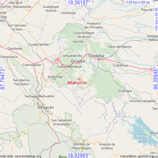
Atlahuilco GPS coordinates[2]
18° 41' 49.812" North, 97° 5' 29.76" West
| Map corner | latitude | longitude |
|---|---|---|
| Upper-left | 19.36187°, | -97.79473° |
| Center: | 18.69717°, | -97.0916° |
| Lower-right: | 18.02985°, | -96.38848° |
| Map W x H: | 148.1×148.1 km | = 92×92mi |
| max Lat: | 32.7° ⇑70.3% North |
| Atlahuilco: | 18.69717° |
| min Lat: | ⇓29.7% South 14.53588° |
| min Long | Atlahuilco | max Long |
| -117.105° | -97.0916° | -86.73105° |
| W 73.7%⇐ | ⇒26.3% E |
Elevation
Elevation of Atlahuilco is 1760 m = 5774 ft, and this is 506.3 m = 1661 ft above average elevation for this country.
| Max E: |
3497 m = 11473 ft | 38% |
| Atlahuilco | 1760 m 5774 ft | |
| Avg. | 1253.7 m = 4113 ft | |
Min E: |
-1 m = -3 ft | 62% |
See also: Mexico elevation on elevation.city.
Geographical zone
Atlahuilco is located in North Torrid zone (between Equator and Tropic of Cancer). Distance of this Northern Tropic circle is 527 km =327.5 mi to North.| Distance of | km | miles | from Atlahuilco |
|---|---|---|---|
| North Pole | 7928.1 | 4926.3 | to North |
| Arctic Circle | 5322.2 | 3307.1 | to North |
| Tropic Cancer | 527 | 327.5 | to North |
| Equator | 2078.9 | 1291.8 | to South |


Nearby cities:
15 places around Atlahuilco: (largest is in red/bold)
• Atlanca
3.9 km =2.4 mi,  86°
86°
• Capultitla
8.5 km =5.3 mi,  37°
37°
• Los Reyes
5.9 km =3.7 mi,  119°
119°
• Magdalena
8.5 km =5.3 mi,  34°
34°
• Mexcala
7.7 km =4.8 mi,  268°
268°
• Monterrey
7.5 km =4.7 mi,  309°
309°
• Santa Cruz
3.8 km =2.4 mi,  22°
22°
• Tequila
4.3 km =2.7 mi, 32°
• Tlatilpa
6.9 km =4.3 mi, 306°
• Tlatzala
6.3 km =3.9 mi,  303°
303°
• Tlilcalco
8.3 km =5.2 mi,  218°
218°
• Tolapa
4.9 km =3 mi,  9°
9°
• Xibtla
3.1 km =1.9 mi,  141°
141°
• Xonotla
8.1 km =5 mi, 309°
• Zacamilola
3.2 km =2 mi,  165°
165°
Sources, notices
• [Note1] Compared only with cities in Mexico existing in our database
• [Src1] Map data: © OpenStreetMap contributors (CC-BY-SA)
• [Src2] Other city data from geonames.org with taken over terms of usage.
• [Src3] Geographical zone / Annual Mean Temperature by Robert A. Rohde @ Wikipedia
