Urapa geodata
Urapa (Michoacán) is a populated place; located in Mexico in America/Mexico_City (GMT-6) time zone. With population of 697 people, there are 12494 cities with bigger population in this country. Compared to other cities in Mexico, 63% of cities are located further ↑North; 78.8% of cities are located further →East and 64.2% of cities have lower elevation than Urapa. Note1


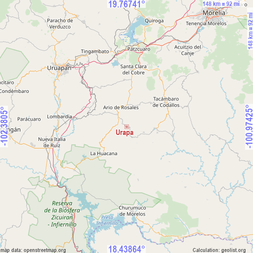
Urapa GPS coordinates[2]
19° 6' 15.696" North, 101° 40' 38.532" West
| Map corner | latitude | longitude |
|---|---|---|
| Upper-left | 19.76741°, | -102.3805° |
| Center: | 19.10436°, | -101.67737° |
| Lower-right: | 18.43864°, | -100.97425° |
| Map W x H: | 147.7×147.7 km | = 91.8×91.8mi |
| max Lat: | 32.7° ⇑63% North |
| Urapa: | 19.10436° |
| min Lat: | ⇓37% South 14.53588° |
| min Long | Urapa | max Long |
| -117.105° | -101.67737° | -86.73105° |
| W 21.2%⇐ | ⇒78.8% E |
Elevation
Elevation of Urapa is 1806 m = 5925 ft, and this is 552.3 m = 1812 ft above average elevation for this country.
| Max E: |
3497 m = 11473 ft | 35.8% |
| Urapa | 1806 m 5925 ft | |
| Avg. | 1253.7 m = 4113 ft | |
Min E: |
-1 m = -3 ft | 64.2% |
See also: Mexico elevation on elevation.city.
Geographical zone
Urapa is located in North Torrid zone (between Equator and Tropic of Cancer). Distance of this Northern Tropic circle is 481.7 km =299.3 mi to North.| Distance of | km | miles | from Urapa |
|---|---|---|---|
| North Pole | 7882.9 | 4898.2 | to North |
| Arctic Circle | 5277 | 3279 | to North |
| Tropic Cancer | 481.7 | 299.3 | to North |
| Equator | 2124.2 | 1319.9 | to South |


Nearby cities:
15 places around Urapa: (largest is in red/bold)
• Ario de Rosales
12.1 km =7.5 mi,  344°
344°
• Doctor Miguel Silva Macías
8.5 km =5.3 mi,  322°
322°
• El Cahulote de Santa Ana
10.5 km =6.5 mi,  107°
107°
• El Chupadero
10.4 km =6.5 mi,  28°
28°
• El Tepamal
16.5 km =10.3 mi,  23°
23°
• La Huerta
17.3 km =10.7 mi,  92°
92°
• Las Puentes
7.5 km =4.7 mi,  160°
160°
• Los Hacheros
12.1 km =7.5 mi,  70°
70°
• Los Tumines
7.6 km =4.7 mi, 319°
• Mata de Plátano
16.6 km =10.3 mi,  193°
193°
• Pablo Cuin
13.1 km =8.1 mi,  7°
7°
• Pinal Grande
10.7 km =6.6 mi, 91°
• Puruarán
16.3 km =10.1 mi, 93°
• Tavera
13.3 km =8.3 mi, 111°
• Zatzio (Tzatzio)
15.1 km =9.4 mi, 30°
Sources, notices
• [Note1] Compared only with cities in Mexico existing in our database
• [Src1] Map data: © OpenStreetMap contributors (CC-BY-SA)
• [Src2] Other city data from geonames.org with taken over terms of usage.
• [Src3] Geographical zone / Annual Mean Temperature by Robert A. Rohde @ Wikipedia
