Achichinalco geodata
Achichinalco (Puebla) is a populated place; located in Mexico in America/Mexico_City (GMT-6) time zone. With population of 541 people, there are 15692 cities with bigger population in this country. Compared to other cities in Mexico, 72.8% of cities are located further ↑North; 75% of cities are located further ←West and 64.6% of cities have lower elevation than Achichinalco. Note1


Achichinalco GPS coordinates[2]
18° 29' 9.996" North, 96° 59' 26.016" West
| Map corner | latitude | longitude |
|---|---|---|
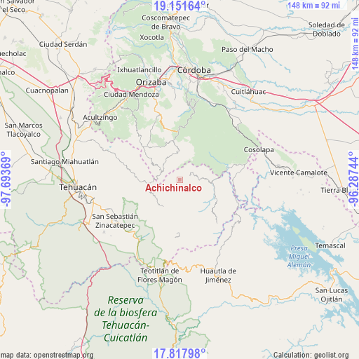
| Upper-left | 19.15164°, | -97.69369° |
| Center: | 18.48611°, | -96.99056° |
| Lower-right: | 17.81798°, | -96.28744° |
| Map W x H: | 148.3×148.3 km | = 92.1×92.1mi |
| max Lat: | 32.7° ⇑72.8% North |
| Achichinalco: | 18.48611° |
| min Lat: | ⇓27.2% South 14.53588° |
| min Long | Achichinalco | max Long |
| -117.105° | -96.99056° | -86.73105° |
| W 75%⇐ | ⇒25% E |
Elevation
Elevation of Achichinalco is 1818 m = 5965 ft, and this is 564.3 m = 1851 ft above average elevation for this country.
| Max E: |
3497 m = 11473 ft | 35.4% |
| Achichinalco | 1818 m 5965 ft | |
| Avg. | 1253.7 m = 4113 ft | |
Min E: |
-1 m = -3 ft | 64.6% |
See also: Mexico elevation on elevation.city.
Geographical zone
Achichinalco is located in North Torrid zone (between Equator and Tropic of Cancer). Distance of this Northern Tropic circle is 550.5 km =342.1 mi to North.| Distance of | km | miles | from Achichinalco |
|---|---|---|---|
| North Pole | 7951.6 | 4940.9 | to North |
| Arctic Circle | 5345.7 | 3321.7 | to North |
| Tropic Cancer | 550.5 | 342.1 | to North |
| Equator | 2055.5 | 1277.2 | to South |


Nearby cities:
15 places around Achichinalco: (largest is in red/bold)
• Achichipico
6.4 km =4 mi,  350°
350°
• Apipitzactitla
6.9 km =4.3 mi,  282°
282°
• Atexacapa
3.9 km =2.4 mi,  32°
32°
• Chiapa
5.3 km =3.3 mi,  113°
113°
• Coxolico
5.7 km =3.5 mi,  226°
226°
• Cuaxuxpa
5.4 km =3.4 mi,  240°
240°
• Eloxochitlán
4.2 km =2.6 mi,  68°
68°
• Esperanza
5.1 km =3.2 mi, 278°
• Huitzmaloc
6.2 km =3.9 mi,  122°
122°
• San Sebastián Alcomunga
6.7 km =4.2 mi,  215°
215°
• Tecpantzacoalco
5.3 km =3.3 mi,  258°
258°
• Tehuipango
7.7 km =4.8 mi,  298°
298°
• Totutla
7.5 km =4.7 mi,  291°
291°
• Xaltepec
7.3 km =4.5 mi, 302°
• Zacatlaixco
6.8 km =4.2 mi, 294°
Sources, notices
• [Note1] Compared only with cities in Mexico existing in our database
• [Src1] Map data: © OpenStreetMap contributors (CC-BY-SA)
• [Src2] Other city data from geonames.org with taken over terms of usage.
• [Src3] Geographical zone / Annual Mean Temperature by Robert A. Rohde @ Wikipedia
