Huitzmaloc geodata
Huitzmaloc (Puebla) is a populated place; located in Mexico in America/Mexico_City (GMT-6) time zone. With population of 1,376 people, there are 6307 cities with bigger population in this country. Compared to other cities in Mexico, 73.1% of cities are located further ↑North; 75.6% of cities are located further ←West and 50.6% of cities have higher elevation than Huitzmaloc. Note1


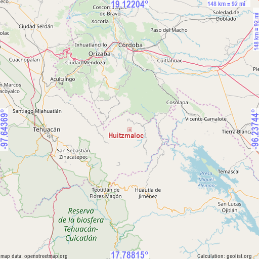
Huitzmaloc GPS coordinates[2]
18° 27' 23.004" North, 96° 56' 26.016" West
| Map corner | latitude | longitude |
|---|---|---|
| Upper-left | 19.12204°, | -97.64369° |
| Center: | 18.45639°, | -96.94056° |
| Lower-right: | 17.78815°, | -96.23744° |
| Map W x H: | 148.3×148.3 km | = 92.1×92.1mi |
| max Lat: | 32.7° ⇑73.1% North |
| Huitzmaloc: | 18.45639° |
| min Lat: | ⇓26.9% South 14.53588° |
| min Long | Huitzmaloc | max Long |
| -117.105° | -96.94056° | -86.73105° |
| W 75.6%⇐ | ⇒24.4% E |
Elevation
Elevation of Huitzmaloc is 1398 m = 4587 ft, and this is 144.3 m = 473 ft above average elevation for this country.
| Max E: |
3497 m = 11473 ft | 50.6% |
| Huitzmaloc | 1398 m 4587 ft | |
| Avg. | 1253.7 m = 4113 ft | |
Min E: |
-1 m = -3 ft | 49.4% |
See also: Mexico elevation on elevation.city.
Geographical zone
Huitzmaloc is located in North Torrid zone (between Equator and Tropic of Cancer). Distance of this Northern Tropic circle is 553.8 km =344.1 mi to North.| Distance of | km | miles | from Huitzmaloc |
|---|---|---|---|
| North Pole | 7954.9 | 4942.9 | to North |
| Arctic Circle | 5349 | 3323.7 | to North |
| Tropic Cancer | 553.8 | 344.1 | to North |
| Equator | 2052.2 | 1275.2 | to South |


Nearby cities:
15 places around Huitzmaloc: (largest is in red/bold)
• Achichinalco
6.2 km =3.9 mi,  302°
302°
• Atexacapa
7.3 km =4.5 mi,  334°
334°
• Chiapa
1.3 km =0.8 mi,  338°
338°
• Coxolico
9.4 km =5.8 mi,  266°
266°
• Coyolapa
7.6 km =4.7 mi,  127°
127°
• Cuabcapula
9.6 km =6 mi,  240°
240°
• Cuaxuxpa
10 km =6.2 mi, 273°
• Eloxochitlán
5 km =3.1 mi, 344°
• Loma Bonita
9.9 km =6.2 mi,  50°
50°
• Papaloapan
8.9 km =5.5 mi,  3°
3°
• San Sebastián Alcomunga
9.4 km =5.8 mi,  256°
256°
• Tecpantzacoalco
10.7 km =6.6 mi,  282°
282°
• Tepepan
9.1 km =5.7 mi,  23°
23°
• Tepetlampa
10.8 km =6.7 mi, 2°
• Xonotipan de Juárez
6.1 km =3.8 mi, 48°
Sources, notices
• [Note1] Compared only with cities in Mexico existing in our database
• [Src1] Map data: © OpenStreetMap contributors (CC-BY-SA)
• [Src2] Other city data from geonames.org with taken over terms of usage.
• [Src3] Geographical zone / Annual Mean Temperature by Robert A. Rohde @ Wikipedia
