Atexacapa geodata
Atexacapa (Puebla) is a populated place; located in Mexico in America/Mexico_City (GMT-6) time zone. With population of 689 people, there are 12616 cities with bigger population in this country. Compared to other cities in Mexico, 72.4% of cities are located further ↑North; 75.3% of cities are located further ←West and 55.3% of cities have lower elevation than Atexacapa. Note1


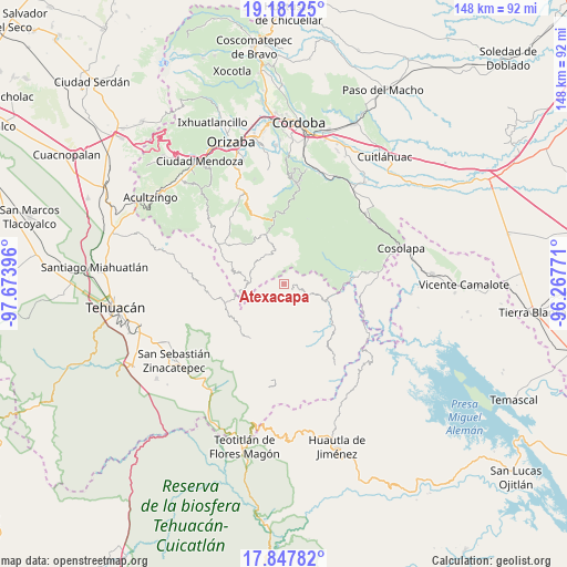
Atexacapa GPS coordinates[2]
18° 30' 56.988" North, 96° 58' 14.988" West
| Map corner | latitude | longitude |
|---|---|---|
| Upper-left | 19.18125°, | -97.67396° |
| Center: | 18.51583°, | -96.97083° |
| Lower-right: | 17.84782°, | -96.26771° |
| Map W x H: | 148.3×148.3 km | = 92.1×92.1mi |
| max Lat: | 32.7° ⇑72.4% North |
| Atexacapa: | 18.51583° |
| min Lat: | ⇓27.6% South 14.53588° |
| min Long | Atexacapa | max Long |
| -117.105° | -96.97083° | -86.73105° |
| W 75.3%⇐ | ⇒24.7% E |
Elevation
Elevation of Atexacapa is 1598 m = 5243 ft, and this is 344.3 m = 1130 ft above average elevation for this country.
| Max E: |
3497 m = 11473 ft | 44.7% |
| Atexacapa | 1598 m 5243 ft | |
| Avg. | 1253.7 m = 4113 ft | |
Min E: |
-1 m = -3 ft | 55.3% |
See also: Mexico elevation on elevation.city.
Geographical zone
Atexacapa is located in North Torrid zone (between Equator and Tropic of Cancer). Distance of this Northern Tropic circle is 547.2 km =340 mi to North.| Distance of | km | miles | from Atexacapa |
|---|---|---|---|
| North Pole | 7948.3 | 4938.8 | to North |
| Arctic Circle | 5342.4 | 3319.6 | to North |
| Tropic Cancer | 547.2 | 340 | to North |
| Equator | 2058.8 | 1279.3 | to South |


Nearby cities:
15 places around Atexacapa: (largest is in red/bold)
• Achichinalco
3.9 km =2.4 mi,  212°
212°
• Achichipico
4.4 km =2.7 mi,  313°
313°
• Chiapa
6.1 km =3.8 mi,  153°
153°
• Eloxochitlán
2.5 km =1.6 mi,  134°
134°
• Esperanza
7.6 km =4.7 mi,  250°
250°
• Huitzmaloc
7.3 km =4.5 mi, 154°
• Opotzinga
5.8 km =3.6 mi,  317°
317°
• Papaloapan
4.4 km =2.7 mi,  58°
58°
• Tecpantzacoalco
8.4 km =5.2 mi,  239°
239°
• Tepepan
7.1 km =4.4 mi,  75°
75°
• Tepetlampa
5.5 km =3.4 mi,  41°
41°
• Xaltepec
8.3 km =5.2 mi,  274°
274°
• Xonotipan de Juárez
8.2 km =5.1 mi,  108°
108°
• Zacatlaixco
8.3 km =5.2 mi, 266°
• Zapaltecatl
8.4 km =5.2 mi, 37°
Sources, notices
• [Note1] Compared only with cities in Mexico existing in our database
• [Src1] Map data: © OpenStreetMap contributors (CC-BY-SA)
• [Src2] Other city data from geonames.org with taken over terms of usage.
• [Src3] Geographical zone / Annual Mean Temperature by Robert A. Rohde @ Wikipedia
