Chiapa geodata
Chiapa (Puebla) is a populated place; located in Mexico in America/Mexico_City (GMT-6) time zone. With population of 808 people, there are 10815 cities with bigger population in this country. Compared to other cities in Mexico, 73% of cities are located further ↑North; 75.6% of cities are located further ←West and 50.1% of cities have higher elevation than Chiapa. Note1


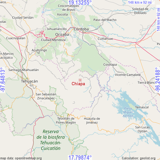
Chiapa GPS coordinates[2]
18° 28' 0.984" North, 96° 56' 42" West
| Map corner | latitude | longitude |
|---|---|---|
| Upper-left | 19.13255°, | -97.64813° |
| Center: | 18.46694°, | -96.945° |
| Lower-right: | 17.79874°, | -96.24188° |
| Map W x H: | 148.3×148.3 km | = 92.1×92.1mi |
| max Lat: | 32.7° ⇑73% North |
| Chiapa: | 18.46694° |
| min Lat: | ⇓27% South 14.53588° |
| min Long | Chiapa | max Long |
| -117.105° | -96.945° | -86.73105° |
| W 75.6%⇐ | ⇒24.4% E |
Elevation
Elevation of Chiapa is 1425 m = 4675 ft, and this is 171.3 m = 562 ft above average elevation for this country.
| Max E: |
3497 m = 11473 ft | 50.1% |
| Chiapa | 1425 m 4675 ft | |
| Avg. | 1253.7 m = 4113 ft | |
Min E: |
-1 m = -3 ft | 49.9% |
See also: Mexico elevation on elevation.city.
Geographical zone
Chiapa is located in North Torrid zone (between Equator and Tropic of Cancer). Distance of this Northern Tropic circle is 552.6 km =343.4 mi to North.| Distance of | km | miles | from Chiapa |
|---|---|---|---|
| North Pole | 7953.7 | 4942.2 | to North |
| Arctic Circle | 5347.8 | 3323 | to North |
| Tropic Cancer | 552.6 | 343.4 | to North |
| Equator | 2053.3 | 1275.9 | to South |


Nearby cities:
15 places around Chiapa: (largest is in red/bold)
• Achichinalco
5.3 km =3.3 mi,  293°
293°
• Atexacapa
6.1 km =3.8 mi,  333°
333°
• Coxolico
9.1 km =5.7 mi,  258°
258°
• Coyolapa
8.7 km =5.4 mi,  131°
131°
• Cuabcapula
9.9 km =6.2 mi,  233°
233°
• Cuaxuxpa
9.6 km =6 mi,  266°
266°
• Eloxochitlán
3.8 km =2.4 mi,  346°
346°
• Huitzmaloc
1.3 km =0.8 mi,  158°
158°
• Loma Bonita
9.6 km =6 mi,  57°
57°
• Papaloapan
7.8 km =4.8 mi,  7°
7°
• San Sebastián Alcomunga
9.2 km =5.7 mi,  248°
248°
• Tecpantzacoalco
10 km =6.2 mi,  276°
276°
• Tepepan
8.3 km =5.2 mi,  29°
29°
• Tepetlampa
9.7 km =6 mi, 5°
• Xonotipan de Juárez
5.8 km =3.6 mi, 60°
Sources, notices
• [Note1] Compared only with cities in Mexico existing in our database
• [Src1] Map data: © OpenStreetMap contributors (CC-BY-SA)
• [Src2] Other city data from geonames.org with taken over terms of usage.
• [Src3] Geographical zone / Annual Mean Temperature by Robert A. Rohde @ Wikipedia
