San Andrés Coapa geodata
San Andrés Coapa (Michoacán) is a populated place; located in Mexico in America/Mexico_City (GMT-6) time zone. With population of 524 people, there are 16113 cities with bigger population in this country. Compared to other cities in Mexico, 54.1% of cities are located further ↑North; 76.3% of cities are located further →East and 82.3% of cities have lower elevation than San Andrés Coapa. Note1


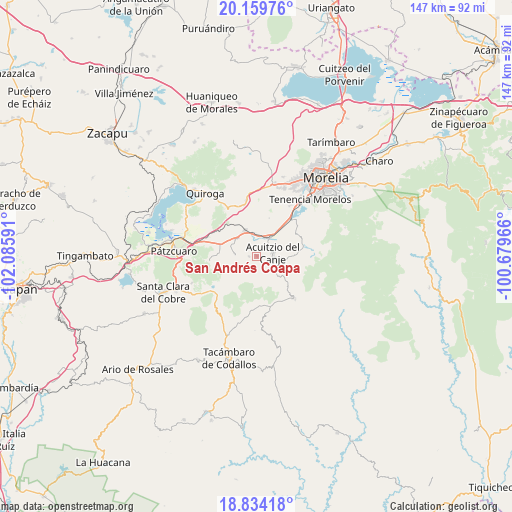
San Andrés Coapa GPS coordinates[2]
19° 29' 53.988" North, 101° 22' 58.008" West
| Map corner | latitude | longitude |
|---|---|---|
| Upper-left | 20.15976°, | -102.08591° |
| Center: | 19.49833°, | -101.38278° |
| Lower-right: | 18.83418°, | -100.67966° |
| Map W x H: | 147.4×147.4 km | = 91.6×91.6mi |
| max Lat: | 32.7° ⇑54.1% North |
| San Andrés Coapa: | 19.49833° |
| min Lat: | ⇓45.9% South 14.53588° |
| min Long | San Andrés Coa | max Long |
| -117.105° | -101.38278° | -86.73105° |
| W 23.7%⇐ | ⇒76.3% E |
Elevation
Elevation of San Andrés Coapa is 2196 m = 7205 ft, and this is 942.3 m = 3092 ft above average elevation for this country.
| Max E: |
3497 m = 11473 ft | 17.7% |
| San Andrés Coapa | 2196 m 7205 ft | |
| Avg. | 1253.7 m = 4113 ft | |
Min E: |
-1 m = -3 ft | 82.3% |
See also: Mexico elevation on elevation.city.
Geographical zone
San Andrés Coapa is located in North Torrid zone (between Equator and Tropic of Cancer). Distance of this Northern Tropic circle is 437.9 km =272.1 mi to North.| Distance of | km | miles | from San Andrés Coapa |
|---|---|---|---|
| North Pole | 7839.1 | 4871 | to North |
| Arctic Circle | 5233.2 | 3251.8 | to North |
| Tropic Cancer | 437.9 | 272.1 | to North |
| Equator | 2168 | 1347.1 | to South |


Nearby cities:
15 places around San Andrés Coapa: (largest is in red/bold)
• Acuítzio del Canje
5.2 km =3.2 mi,  93°
93°
• Canacucho
11.6 km =7.2 mi,  259°
259°
• Chihuerio
2 km =1.2 mi,  218°
218°
• Cutzaro
7.6 km =4.7 mi,  137°
137°
• El Pedregal
7.1 km =4.4 mi,  281°
281°
• El Refugio
11.7 km =7.3 mi,  254°
254°
• El Sobrado
8.6 km =5.3 mi, 282°
• Huiramba
7.7 km =4.8 mi,  313°
313°
• La Caja
11.2 km =7 mi,  331°
331°
• Lagunillas
8 km =5 mi, 334°
• Las Tablas
6.1 km =3.8 mi,  272°
272°
• San José Coapa
6.6 km =4.1 mi,  356°
356°
• San Rafael Coapa
3.8 km =2.4 mi,  33°
33°
• Tirípetio
6.8 km =4.2 mi, 33°
• Tupátaro
11.5 km =7.1 mi, 272°
Sources, notices
• [Note1] Compared only with cities in Mexico existing in our database
• [Src1] Map data: © OpenStreetMap contributors (CC-BY-SA)
• [Src2] Other city data from geonames.org with taken over terms of usage.
• [Src3] Geographical zone / Annual Mean Temperature by Robert A. Rohde @ Wikipedia
