Plan de Ayala geodata
Plan de Ayala (Veracruz) is a populated place; located in Mexico in America/Mexico_City (GMT-6) time zone. With population of 522 people, there are 16162 cities with bigger population in this country. Compared to other cities in Mexico, 65.5% of cities are located further ↑North; 76.3% of cities are located further ←West and 54.1% of cities have higher elevation than Plan de Ayala. Note1


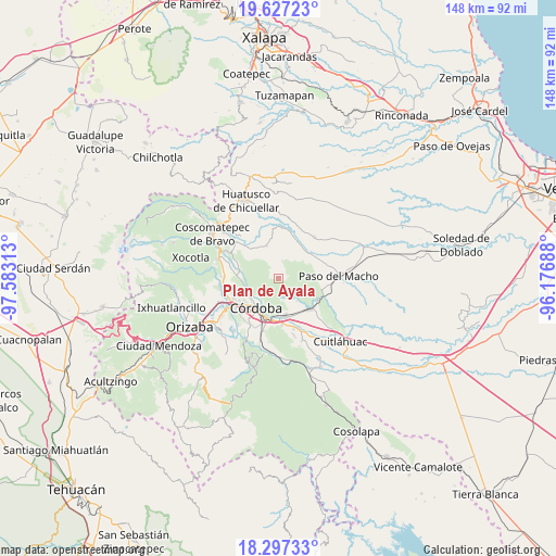
Plan de Ayala GPS coordinates[2]
18° 57' 48.996" North, 96° 52' 48" West
| Map corner | latitude | longitude |
|---|---|---|
| Upper-left | 19.62723°, | -97.58313° |
| Center: | 18.96361°, | -96.88° |
| Lower-right: | 18.29733°, | -96.17688° |
| Map W x H: | 147.9×147.9 km | = 91.9×91.9mi |
| max Lat: | 32.7° ⇑65.5% North |
| Plan de Ayala: | 18.96361° |
| min Lat: | ⇓34.5% South 14.53588° |
| min Long | Plan de Ayala | max Long |
| -117.105° | -96.88° | -86.73105° |
| W 76.3%⇐ | ⇒23.7% E |
Elevation
Elevation of Plan de Ayala is 1238 m = 4062 ft, and this is 15.7 m = 52 ft below average elevation for this country.
| Max E: |
3497 m = 11473 ft | 54.1% |
| Avg. | 1253.7 m = 4113 ft | |
| Plan de Ayala | 1238 m = 4062 ft | |
Min E: |
-1 m = -3 ft | 45.9% |
See also: Mexico elevation on elevation.city.
Geographical zone
Plan de Ayala is located in North Torrid zone (between Equator and Tropic of Cancer). Distance of this Northern Tropic circle is 497.4 km =309.1 mi to North.| Distance of | km | miles | from Plan de Ayala |
|---|---|---|---|
| North Pole | 7898.5 | 4907.9 | to North |
| Arctic Circle | 5292.6 | 3288.7 | to North |
| Tropic Cancer | 497.4 | 309.1 | to North |
| Equator | 2108.6 | 1310.2 | to South |


Nearby cities:
15 places around Plan de Ayala: (largest is in red/bold)
• Berlín
6.7 km =4.2 mi,  221°
221°
• Cañada Blanca
2.9 km =1.8 mi,  116°
116°
• Ejido los Naranjos
2.3 km =1.4 mi,  80°
80°
• El Bajío
7 km =4.3 mi,  312°
312°
• El Porvenir
6.8 km =4.2 mi,  225°
225°
• Guzmantla
7.2 km =4.5 mi,  320°
320°
• Ignacio Zaragoza
7 km =4.3 mi,  136°
136°
• La Charca
7.3 km =4.5 mi,  86°
86°
• Miguel Aguilar
3.4 km =2.1 mi, 218°
• Progreso
6.7 km =4.2 mi,  53°
53°
• San José Loma Grande
6.9 km =4.3 mi,  300°
300°
• San José Tenejapa
7 km =4.3 mi,  33°
33°
• San Matías
7.3 km =4.5 mi, 219°
• San Rafael Calería
7.2 km =4.5 mi,  248°
248°
• Álvaro Obregón
4.9 km =3 mi,  12°
12°
Sources, notices
• [Note1] Compared only with cities in Mexico existing in our database
• [Src1] Map data: © OpenStreetMap contributors (CC-BY-SA)
• [Src2] Other city data from geonames.org with taken over terms of usage.
• [Src3] Geographical zone / Annual Mean Temperature by Robert A. Rohde @ Wikipedia
