El Bajío geodata
El Bajío (Veracruz) is a populated place; located in Mexico in America/Mexico_City (GMT-6) time zone. With population of 993 people, there are 8774 cities with bigger population in this country. Compared to other cities in Mexico, 64.6% of cities are located further ↑North; 75.8% of cities are located further ←West and 56.1% of cities have higher elevation than El Bajío. Note1


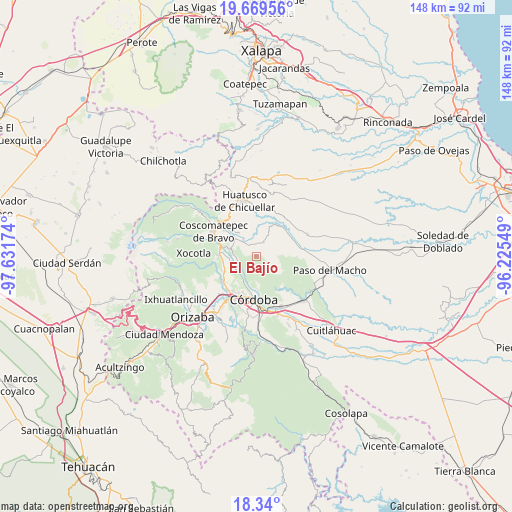
El Bajío GPS coordinates[2]
19° 0' 21.996" North, 96° 55' 42.996" West
| Map corner | latitude | longitude |
|---|---|---|
| Upper-left | 19.66956°, | -97.63174° |
| Center: | 19.00611°, | -96.92861° |
| Lower-right: | 18.34°, | -96.22549° |
| Map W x H: | 147.8×147.8 km | = 91.8×91.8mi |
| max Lat: | 32.7° ⇑64.6% North |
| El Bajío: | 19.00611° |
| min Lat: | ⇓35.4% South 14.53588° |
| min Long | El Bajío | max Long |
| -117.105° | -96.92861° | -86.73105° |
| W 75.8%⇐ | ⇒24.2% E |
Elevation
Elevation of El Bajío is 1154 m = 3786 ft, and this is 99.7 m = 327 ft below average elevation for this country.
| Max E: |
3497 m = 11473 ft | 56.1% |
| Avg. | 1253.7 m = 4113 ft | |
| El Bajío | 1154 m = 3786 ft | |
Min E: |
-1 m = -3 ft | 43.9% |
See also: Mexico elevation on elevation.city.
Geographical zone
El Bajío is located in North Torrid zone (between Equator and Tropic of Cancer). Distance of this Northern Tropic circle is 492.6 km =306.1 mi to North.| Distance of | km | miles | from El Bajío |
|---|---|---|---|
| North Pole | 7893.8 | 4905 | to North |
| Arctic Circle | 5287.9 | 3285.7 | to North |
| Tropic Cancer | 492.6 | 306.1 | to North |
| Equator | 2113.3 | 1313.1 | to South |


Nearby cities:
15 places around El Bajío: (largest is in red/bold)
• El Palenque Palotal
6.8 km =4.2 mi,  231°
231°
• Guzmantla
1 km =0.6 mi,  31°
31°
• Ixcapantla
4.9 km =3 mi,  296°
296°
• Ixcatla
7.8 km =4.8 mi,  7°
7°
• Ixhuatlán del Café
7.7 km =4.8 mi,  310°
310°
• Ocotitlán
4.6 km =2.9 mi, 27°
• Plan de Ayala
7 km =4.3 mi,  132°
132°
• San José Loma Grande
1.5 km =0.9 mi,  214°
214°
• San José Neria
7.6 km =4.7 mi,  259°
259°
• San Rafael Calería
7.5 km =4.7 mi,  192°
192°
• Tecama
6 km =3.7 mi,  267°
267°
• Tecama Calería (Sabana Larga)
6 km =3.7 mi,  239°
239°
• Tecamilla
6.1 km =3.8 mi, 260°
• Zacamitla
5 km =3.1 mi, 5°
• Álvaro Obregón
6.2 km =3.9 mi,  89°
89°
Sources, notices
• [Note1] Compared only with cities in Mexico existing in our database
• [Src1] Map data: © OpenStreetMap contributors (CC-BY-SA)
• [Src2] Other city data from geonames.org with taken over terms of usage.
• [Src3] Geographical zone / Annual Mean Temperature by Robert A. Rohde @ Wikipedia
