San José Loma Grande geodata
San José Loma Grande (Veracruz) is a populated place; located in Mexico in America/Mexico_City (GMT-6) time zone. With population of 912 people, there are 9567 cities with bigger population in this country. Compared to other cities in Mexico, 64.8% of cities are located further ↑North; 75.7% of cities are located further ←West and 51% of cities have lower elevation than San José Loma Grande. Note1
Current local time in San José Loma Grande:
07:06 AM, WednesdayDifference from your time zone: hours


San José Loma Grande GPS coordinates[2]
18° 59' 40.992" North, 96° 56' 12.984" West
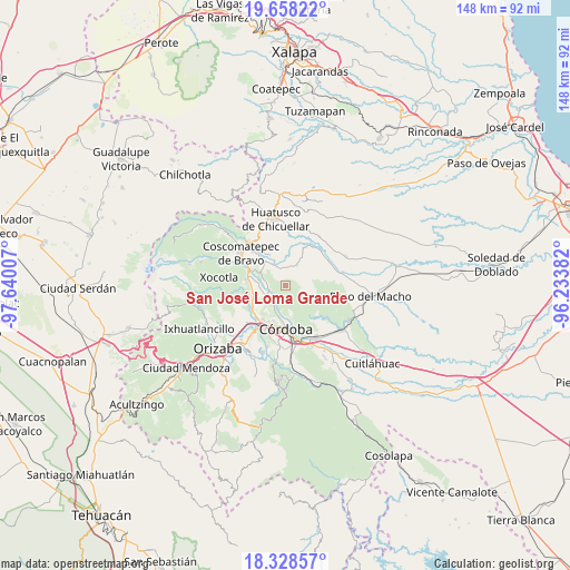
| Map corner | latitude | longitude |
|---|---|---|
| Upper-left | 19.65822°, | -97.64007° |
| Center: | 18.99472°, | -96.93694° |
| Lower-right: | 18.32857°, | -96.23382° |
| Map W x H: | 147.8×147.8 km | = 91.8×91.8mi |
| max Lat: | 32.7° ⇑64.8% North |
| San José Loma Grande: | 18.99472° |
| min Lat: | ⇓35.2% South 14.53588° |
| min Long | San José Loma | max Long |
| -117.105° | -96.93694° | -86.73105° |
| W 75.7%⇐ | ⇒24.3% E |
Elevation
Elevation of San José Loma Grande is 1484 m = 4869 ft, and this is 230.3 m = 756 ft above average elevation for this country.
| Max E: |
3497 m = 11473 ft | 49% |
| San José Loma Grande | 1484 m 4869 ft | |
| Avg. | 1253.7 m = 4113 ft | |
Min E: |
-1 m = -3 ft | 51% |
See also: Mexico elevation on elevation.city.
Geographical zone
San José Loma Grande is located in North Torrid zone (between Equator and Tropic of Cancer). Distance of this Northern Tropic circle is 493.9 km =306.9 mi to North.| Distance of | km | miles | from San José Loma Grande |
|---|---|---|---|
| North Pole | 7895 | 4905.7 | to North |
| Arctic Circle | 5289.2 | 3286.6 | to North |
| Tropic Cancer | 493.9 | 306.9 | to North |
| Equator | 2112 | 1312.3 | to South |


Nearby cities:
15 places around San José Loma Grande: (largest is in red/bold)
• El Bajío
1.5 km =0.9 mi,  34°
34°
• El Palenque Palotal
5.4 km =3.4 mi,  235°
235°
• Guzmantla
2.5 km =1.6 mi, 33°
• Ixcapantla
4.9 km =3 mi,  314°
314°
• Miguel Aguilar
7.2 km =4.5 mi,  147°
147°
• Ocotitlán
6.1 km =3.8 mi, 29°
• Plan de Ayala
6.9 km =4.3 mi,  120°
120°
• San Isidro Palotal
6.4 km =4 mi,  208°
208°
• San José Neria
6.5 km =4 mi,  268°
268°
• San Rafael Calería
6.1 km =3.8 mi,  186°
186°
• Tecama
5.2 km =3.2 mi,  281°
281°
• Tecama Calería (Sabana Larga)
4.6 km =2.9 mi,  248°
248°
• Tecamilla
5.1 km =3.2 mi, 272°
• Zacamitla
6.4 km =4 mi,  12°
12°
• Álvaro Obregón
7.2 km =4.5 mi,  79°
79°
Sources, notices
• [Note1] Compared only with cities in Mexico existing in our database
• [Src1] Map data: © OpenStreetMap contributors (CC-BY-SA)
• [Src2] Other city data from geonames.org with taken over terms of usage.
• [Src3] Geographical zone / Annual Mean Temperature by Robert A. Rohde @ Wikipedia
