Tlapacoya geodata
Tlapacoya (Puebla) is a populated place; located in Mexico in America/Mexico_City (GMT-6) time zone. With population of 674 people, there are 12893 cities with bigger population in this country. Compared to other cities in Mexico, 59.7% of cities are located further ↓South; 65.4% of cities are located further ←West and 58.4% of cities have higher elevation than Tlapacoya. Note1


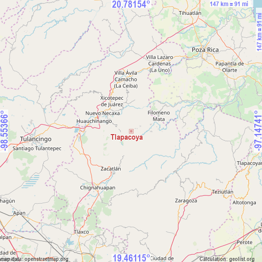
Tlapacoya GPS coordinates[2]
20° 7' 21.864" North, 97° 51' 1.908" West
| Map corner | latitude | longitude |
|---|---|---|
| Upper-left | 20.78154°, | -98.55366° |
| Center: | 20.12274°, | -97.85053° |
| Lower-right: | 19.46115°, | -97.14741° |
| Map W x H: | 146.8×146.8 km | = 91.2×91.2mi |
| max Lat: | 32.7° ⇑40.3% North |
| Tlapacoya: | 20.12274° |
| min Lat: | ⇓59.7% South 14.53588° |
| min Long | Tlapacoya | max Long |
| -117.105° | -97.85053° | -86.73105° |
| W 65.4%⇐ | ⇒34.6% E |
Elevation
Elevation of Tlapacoya is 1088 m = 3570 ft, and this is 165.7 m = 544 ft below average elevation for this country.
| Max E: |
3497 m = 11473 ft | 58.4% |
| Avg. | 1253.7 m = 4113 ft | |
| Tlapacoya | 1088 m = 3570 ft | |
Min E: |
-1 m = -3 ft | 41.6% |
See also: Mexico elevation on elevation.city.
Geographical zone
Tlapacoya is located in North Torrid zone (between Equator and Tropic of Cancer). Distance of this Northern Tropic circle is 368.5 km =229 mi to North.| Distance of | km | miles | from Tlapacoya |
|---|---|---|---|
| North Pole | 7769.6 | 4827.8 | to North |
| Arctic Circle | 5163.7 | 3208.6 | to North |
| Tropic Cancer | 368.5 | 229 | to North |
| Equator | 2237.4 | 1390.3 | to South |


Nearby cities:
15 places around Tlapacoya: (largest is in red/bold)
• Ahuacatlaya
6.6 km =4.1 mi,  21°
21°
• Altica
6.4 km =4 mi,  127°
127°
• Cuautotola
8.2 km =5.1 mi,  137°
137°
• Cutzontipa
5.8 km =3.6 mi,  257°
257°
• Jojupango (San Miguel Jojupango)
8.7 km =5.4 mi,  109°
109°
• La Cruz
3.7 km =2.3 mi,  67°
67°
• La Cumbre
0.5 km =0.3 mi,  225°
225°
• Quamila
8.6 km =5.3 mi,  304°
304°
• San Cristóbal Xochimilpa
8.6 km =5.3 mi,  223°
223°
• San Martín del Progreso (La Punta)
7.4 km =4.6 mi,  88°
88°
• Tlacotepec (San Mateo)
6.9 km =4.3 mi,  178°
178°
• Tlaltepango
3.8 km =2.4 mi,  311°
311°
• Tlamaya Chico
2.6 km =1.6 mi,  59°
59°
• Tlamaya Grande
5.6 km =3.5 mi, 61°
• Tlaola
7.8 km =4.8 mi,  283°
283°
Sources, notices
• [Note1] Compared only with cities in Mexico existing in our database
• [Src1] Map data: © OpenStreetMap contributors (CC-BY-SA)
• [Src2] Other city data from geonames.org with taken over terms of usage.
• [Src3] Geographical zone / Annual Mean Temperature by Robert A. Rohde @ Wikipedia
