Cuatotolapan Viejo geodata
Cuatotolapan Viejo (Veracruz) is a populated place; located in Mexico in America/Mexico_City (GMT-6) time zone. With population of 689 people, there are 12616 cities with bigger population in this country. Compared to other cities in Mexico, 77% of cities are located further ↑North; 83.7% of cities are located further ←West and 87.2% of cities have higher elevation than Cuatotolapan Viejo. Note1


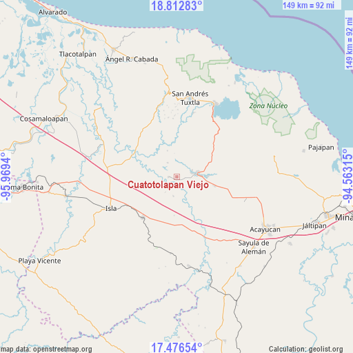
Cuatotolapan Viejo GPS coordinates[2]
18° 8' 45.456" North, 95° 15' 58.572" West
| Map corner | latitude | longitude |
|---|---|---|
| Upper-left | 18.81283°, | -95.9694° |
| Center: | 18.14596°, | -95.26627° |
| Lower-right: | 17.47654°, | -94.56315° |
| Map W x H: | 148.6×148.6 km | = 92.3×92.3mi |
| max Lat: | 32.7° ⇑77% North |
| Cuatotolapan Viejo: | 18.14596° |
| min Lat: | ⇓23% South 14.53588° |
| min Long | Cuatotolapan Vi | max Long |
| -117.105° | -95.26627° | -86.73105° |
| W 83.7%⇐ | ⇒16.3% E |
Elevation
Elevation of Cuatotolapan Viejo is 33 m = 108 ft, and this is 1220.7 m = 4005 ft below average elevation for this country.
| Max E: |
3497 m = 11473 ft | 87.2% |
| Avg. | 1253.7 m = 4113 ft | |
| Cuatotolapan Viejo | 33 m = 108 ft | |
Min E: |
-1 m = -3 ft | 12.8% |
See also: Mexico elevation on elevation.city.
Geographical zone
Cuatotolapan Viejo is located in North Torrid zone (between Equator and Tropic of Cancer). Distance of this Northern Tropic circle is 588.3 km =365.6 mi to North.| Distance of | km | miles | from Cuatotolapan Viejo |
|---|---|---|---|
| North Pole | 7989.4 | 4964.4 | to North |
| Arctic Circle | 5383.5 | 3345.2 | to North |
| Tropic Cancer | 588.3 | 365.6 | to North |
| Equator | 2017.6 | 1253.7 | to South |


Nearby cities:
15 places around Cuatotolapan Viejo: (largest is in red/bold)
• El Blanco
8.1 km =5 mi,  190°
190°
• El Laurel
15.7 km =9.8 mi,  335°
335°
• El Popotal
11.8 km =7.3 mi, 340°
• El Sauzal
6.2 km =3.9 mi,  48°
48°
• Hueyapan de Ocampo
12.4 km =7.7 mi,  90°
90°
• Juan Díaz Covarrubias
8.5 km =5.3 mi,  79°
79°
• La Cañada
8 km =5 mi,  218°
218°
• La Gloria
6.9 km =4.3 mi,  66°
66°
• Loma de Hujuapan
15.9 km =9.9 mi,  159°
159°
• Loma de los Ingleses
9.7 km =6 mi, 93°
• Nopalapan
7.8 km =4.8 mi,  241°
241°
• Norma
7.2 km =4.5 mi,  326°
326°
• San Ángel
15.5 km =9.6 mi,  102°
102°
• Santa Catalina
6.5 km =4 mi, 72°
• Zapoapan de Amapan
13.4 km =8.3 mi,  40°
40°
Sources, notices
• [Note1] Compared only with cities in Mexico existing in our database
• [Src1] Map data: © OpenStreetMap contributors (CC-BY-SA)
• [Src2] Other city data from geonames.org with taken over terms of usage.
• [Src3] Geographical zone / Annual Mean Temperature by Robert A. Rohde @ Wikipedia
