Tlacolulan geodata
Tlacolulan (Veracruz) is a seat of a second-order administrative division; located in Mexico in America/Mexico_City (GMT-6) time zone. With population of 1,453 people, there are 5939 cities with bigger population in this country. Compared to other cities in Mexico, 50.5% of cities are located further ↑North; 74.8% of cities are located further ←West and 61.8% of cities have lower elevation than Tlacolulan. Note1


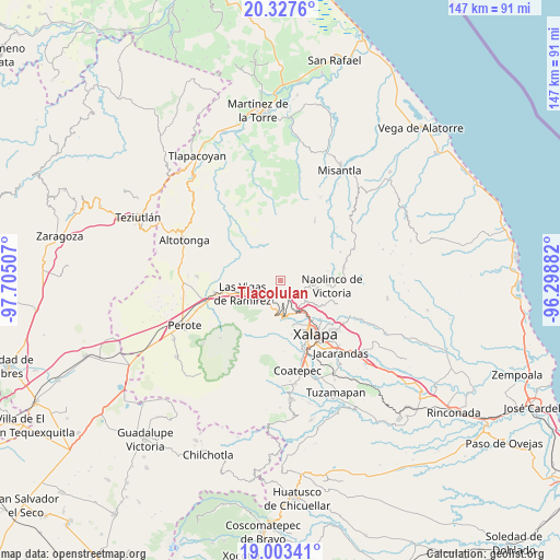
Tlacolulan GPS coordinates[2]
19° 40' 0.732" North, 97° 0' 6.984" West
| Map corner | latitude | longitude |
|---|---|---|
| Upper-left | 20.3276°, | -97.70507° |
| Center: | 19.66687°, | -97.00194° |
| Lower-right: | 19.00341°, | -96.29882° |
| Map W x H: | 147.2×147.2 km | = 91.5×91.5mi |
| max Lat: | 32.7° ⇑50.5% North |
| Tlacolulan: | 19.66687° |
| min Lat: | ⇓49.5% South 14.53588° |
| min Long | Tlacolulan | max Long |
| -117.105° | -97.00194° | -86.73105° |
| W 74.8%⇐ | ⇒25.2% E |
Elevation
Elevation of Tlacolulan is 1755 m = 5758 ft, and this is 501.3 m = 1645 ft above average elevation for this country.
| Max E: |
3497 m = 11473 ft | 38.2% |
| Tlacolulan | 1755 m 5758 ft | |
| Avg. | 1253.7 m = 4113 ft | |
Min E: |
-1 m = -3 ft | 61.8% |
See also: Mexico elevation on elevation.city.
Geographical zone
Tlacolulan is located in North Torrid zone (between Equator and Tropic of Cancer). Distance of this Northern Tropic circle is 419.2 km =260.5 mi to North.| Distance of | km | miles | from Tlacolulan |
|---|---|---|---|
| North Pole | 7820.3 | 4859.3 | to North |
| Arctic Circle | 5214.4 | 3240.1 | to North |
| Tropic Cancer | 419.2 | 260.5 | to North |
| Equator | 2186.8 | 1358.8 | to South |


Nearby cities:
15 places around Tlacolulan: (largest is in red/bold)
• Atlapa Chico
2.2 km =1.4 mi,  306°
306°
• Coacoatzintla
6.7 km =4.2 mi,  104°
104°
• Duraznal
1.4 km =0.9 mi,  131°
131°
• El Fresno
3.8 km =2.4 mi,  147°
147°
• Etlantepec
2.7 km =1.7 mi,  37°
37°
• Huichila
4.3 km =2.7 mi,  270°
270°
• Jilotepec
8.1 km =5 mi,  139°
139°
• Joya Chica
8.6 km =5.3 mi,  193°
193°
• La Joya
6.7 km =4.2 mi,  202°
202°
• Linderos
5.8 km =3.6 mi, 146°
• Los Planes (Cerro Gordo)
7.9 km =4.9 mi,  92°
92°
• Piedra de Agua
8.1 km =5 mi, 149°
• Rafael Lucio
8.3 km =5.2 mi,  171°
171°
• Tonayán
8.6 km =5.3 mi,  78°
78°
• Toxtlacuaya
8.3 km =5.2 mi,  229°
229°
Sources, notices
• [Note1] Compared only with cities in Mexico existing in our database
• [Src1] Map data: © OpenStreetMap contributors (CC-BY-SA)
• [Src2] Other city data from geonames.org with taken over terms of usage.
• [Src3] Geographical zone / Annual Mean Temperature by Robert A. Rohde @ Wikipedia
