Los Planes (Cerro Gordo) geodata
Los Planes (Cerro Gordo) (Veracruz) is a populated place; located in Mexico in America/Mexico_City (GMT-6) time zone. With population of 619 people, there are 13941 cities with bigger population in this country. Compared to other cities in Mexico, 50.6% of cities are located further ↑North; 75.8% of cities are located further ←West and 50.7% of cities have lower elevation than Los Planes (Cerro Gordo). Note1
Current local time in Los Planes (Cerro Gordo):
06:44 AM, WednesdayDifference from your time zone: hours


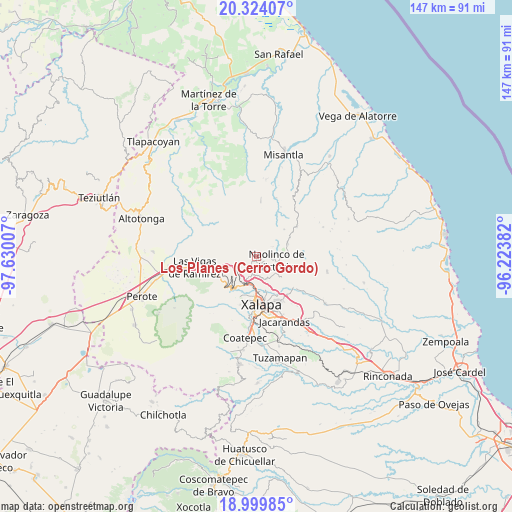
Los Planes (Cerro Gordo) GPS coordinates[2]
19° 39' 47.988" North, 96° 55' 36.984" West
| Map corner | latitude | longitude |
|---|---|---|
| Upper-left | 20.32407°, | -97.63007° |
| Center: | 19.66333°, | -96.92694° |
| Lower-right: | 18.99985°, | -96.22382° |
| Map W x H: | 147.2×147.2 km | = 91.5×91.5mi |
| max Lat: | 32.7° ⇑50.6% North |
| Los Planes (Cerro Gordo): | 19.66333° |
| min Lat: | ⇓49.4% South 14.53588° |
| min Long | Los Planes (Cer | max Long |
| -117.105° | -96.92694° | -86.73105° |
| W 75.8%⇐ | ⇒24.2% E |
Elevation
Elevation of Los Planes (Cerro Gordo) is 1472 m = 4829 ft, and this is 218.3 m = 716 ft above average elevation for this country.
| Max E: |
3497 m = 11473 ft | 49.3% |
| Los Planes (Cerro Gordo) | 1472 m 4829 ft | |
| Avg. | 1253.7 m = 4113 ft | |
Min E: |
-1 m = -3 ft | 50.7% |
See also: Mexico elevation on elevation.city.
Geographical zone
Los Planes (Cerro Gordo) is located in North Torrid zone (between Equator and Tropic of Cancer). Distance of this Northern Tropic circle is 419.6 km =260.7 mi to North.| Distance of | km | miles | from Los Planes (Cerro Gordo) |
|---|---|---|---|
| North Pole | 7820.7 | 4859.6 | to North |
| Arctic Circle | 5214.8 | 3240.3 | to North |
| Tropic Cancer | 419.6 | 260.7 | to North |
| Equator | 2186.4 | 1358.6 | to South |


Nearby cities:
15 places around Los Planes (Cerro Gordo): (largest is in red/bold)
• Coacoatzintla
1.9 km =1.2 mi,  227°
227°
• Duraznal
6.8 km =4.2 mi,  265°
265°
• El Espinal
7.2 km =4.5 mi,  127°
127°
• El Fresno
6.5 km =4 mi,  244°
244°
• Etlantepec
6.7 km =4.2 mi,  291°
291°
• Jilotepec
6.3 km =3.9 mi,  204°
204°
• La Concepción
6.9 km =4.3 mi,  156°
156°
• Las Lomas
4.8 km =3 mi, 159°
• Linderos
6.4 km =4 mi, 226°
• Naolinco de Victoria
5.7 km =3.5 mi,  99°
99°
• Piedras Grandes
4.3 km =2.7 mi,  15°
15°
• Puentezuelos
5.5 km =3.4 mi,  0°
0°
• San Marcos Atesquilapan
5.2 km =3.2 mi,  56°
56°
• Tonayán
2.3 km =1.4 mi, 15°
• Xaltepec
7.1 km =4.4 mi,  184°
184°
Sources, notices
• [Note1] Compared only with cities in Mexico existing in our database
• [Src1] Map data: © OpenStreetMap contributors (CC-BY-SA)
• [Src2] Other city data from geonames.org with taken over terms of usage.
• [Src3] Geographical zone / Annual Mean Temperature by Robert A. Rohde @ Wikipedia
