Ketereh geodata
Ketereh (Kelantan) is a seat of a third-order administrative division; located in Malaysia in Asia/Kuala_Lumpur (GMT+8) time zone. In our database, there are 176 cities with bigger population. Compared to other cities in Malaysia, 87.1% of cities are located further ↓South; 56.2% of cities are located further ←West and 53.9% of cities have lower elevation than Ketereh. Note1


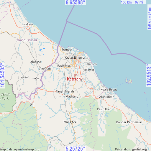
Ketereh GPS coordinates[2]
5° 57' 25.236" North, 102° 14' 53.412" East
| Map corner | latitude | longitude |
|---|---|---|
| Upper-left | 6.65588°, | 101.54505° |
| Center: | 5.95701°, | 102.24817° |
| Lower-right: | 5.25725°, | 102.9513° |
| Map W x H: | 155.5×155.5 km | = 96.6×96.6mi |
| max Lat: | 6.88732° ⇑12.9% North |
| Ketereh: | 5.95701° |
| min Lat: | ⇓87.1% South 1.24722° |
| min Long | Ketereh | max Long |
| 99.68252° | 102.24817° | 118.61119° |
| W 56.2%⇐ | ⇒43.8% E |
Elevation
Elevation of Ketereh is 16 m = 52 ft, and this is 28.7 m = 94 ft below average elevation for this country.
| Max E: |
1488 m = 4882 ft | 46.1% |
| Avg. | 44.7 m = 147 ft | |
| Ketereh | 16 m = 52 ft | |
Min E: |
0 m = 0 ft | 53.9% |
See also: Malaysia elevation on elevation.city.
Geographical zone
Ketereh is located in North Torrid zone (between Equator and Tropic of Cancer). Distance of Equator is 662.4 km =411.6 mi to South.| Distance of | km | miles | from Ketereh |
|---|---|---|---|
| North Pole | 9344.7 | 5806.5 | to North |
| Arctic Circle | 6738.8 | 4187.3 | to North |
| Tropic Cancer | 1943.6 | 1207.7 | to North |
| Equator | 662.4 | 411.6 | to South |


Nearby cities:
15 places around Ketereh: (largest is in red/bold)
• Gua Musang
123.2 km =76.6 mi,  194°
194°
• Jertih
36.5 km =22.7 mi,  132°
132°
• Kampong Kadok
4.8 km =3 mi,  2°
2°
• Kampong Pangkal Kalong
5.7 km =3.5 mi,  217°
217°
• Kampung Kuala Besut
36.2 km =22.5 mi,  112°
112°
• Kampung Lemal
14.4 km =8.9 mi,  304°
304°
• Kota Bharu
18.5 km =11.5 mi,  358°
358°
• Kuala Besut
36.6 km =22.7 mi, 112°
• Kuala Terengganu
120.9 km =75.1 mi, 125°
• Marang
135 km =83.9 mi, 128°
• Pasir Mas
15.8 km =9.8 mi,  310°
310°
• Peringat
9.3 km =5.8 mi,  24°
24°
• Pulai Chondong
9.7 km =6 mi, 190°
• Tanah Merah
20.6 km =12.8 mi,  211°
211°
• Tumpat
28.1 km =17.5 mi,  342°
342°
Sources, notices
• [Note1] Compared only with cities in Malaysia existing in our database
• [Src1] Map data: © OpenStreetMap contributors (CC-BY-SA)
• [Src2] Other city data from geonames.org with taken over terms of usage.
• [Src3] Geographical zone / Annual Mean Temperature by Robert A. Rohde @ Wikipedia
