Kampung Lemal geodata
Kampung Lemal (Kelantan) is a seat of a third-order administrative division; located in Malaysia in Asia/Kuala_Lumpur (GMT+8) time zone. In our database, there are 176 cities with bigger population. Compared to other cities in Malaysia, 88.8% of cities are located further ↓South; 51.7% of cities are located further →East and 58.4% of cities have lower elevation than Kampung Lemal. Note1


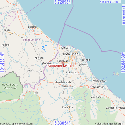
Kampung Lemal GPS coordinates[2]
6° 1' 48.756" North, 102° 8' 28.536" East
| Map corner | latitude | longitude |
|---|---|---|
| Upper-left | 6.72898°, | 101.43814° |
| Center: | 6.03021°, | 102.14126° |
| Lower-right: | 5.33054°, | 102.84439° |
| Map W x H: | 155.5×155.5 km | = 96.6×96.6mi |
| max Lat: | 6.88732° ⇑11.2% North |
| Kampung Lemal: | 6.03021° |
| min Lat: | ⇓88.8% South 1.24722° |
| min Long | Kampung Lemal | max Long |
| 99.68252° | 102.14126° | 118.61119° |
| W 48.3%⇐ | ⇒51.7% E |
Elevation
Elevation of Kampung Lemal is 18 m = 59 ft, and this is 26.7 m = 88 ft below average elevation for this country.
| Max E: |
1488 m = 4882 ft | 41.6% |
| Avg. | 44.7 m = 147 ft | |
| Kampung Lemal | 18 m = 59 ft | |
Min E: |
0 m = 0 ft | 58.4% |
See also: Malaysia elevation on elevation.city.
Geographical zone
Kampung Lemal is located in North Torrid zone (between Equator and Tropic of Cancer). Distance of Equator is 670.5 km =416.6 mi to South.| Distance of | km | miles | from Kampung Lemal |
|---|---|---|---|
| North Pole | 9336.6 | 5801.5 | to North |
| Arctic Circle | 6730.7 | 4182.3 | to North |
| Tropic Cancer | 1935.4 | 1202.6 | to North |
| Equator | 670.5 | 416.6 | to South |


Nearby cities:
15 places around Kampung Lemal: (largest is in red/bold)
• Gua Musang
128.8 km =80 mi,  188°
188°
• Jertih
50.7 km =31.5 mi,  130°
130°
• Kampong Kadok
12.5 km =7.8 mi,  105°
105°
• Kampong Pangkal Kalong
15.1 km =9.4 mi,  146°
146°
• Kampung Kuala Besut
50.3 km =31.3 mi,  115°
115°
• Ketereh
14.4 km =8.9 mi, 124°
• Kota Bharu
15.3 km =9.5 mi,  47°
47°
• Kuala Besut
50.8 km =31.6 mi, 115°
• Kuala Terengganu
135.2 km =84 mi, 125°
• Marang
149.3 km =92.8 mi, 127°
• Pasir Mas
2.1 km =1.3 mi,  355°
355°
• Peringat
15.7 km =9.8 mi,  88°
88°
• Pulai Chondong
20.3 km =12.6 mi, 150°
• Tanah Merah
25.6 km =15.9 mi,  177°
177°
• Tumpat
18.9 km =11.7 mi,  10°
10°
Sources, notices
• [Note1] Compared only with cities in Malaysia existing in our database
• [Src1] Map data: © OpenStreetMap contributors (CC-BY-SA)
• [Src2] Other city data from geonames.org with taken over terms of usage.
• [Src3] Geographical zone / Annual Mean Temperature by Robert A. Rohde @ Wikipedia
