Kota Bharu geodata
Kota Bharu (Kelantan) is a seat of a first-order administrative division; located in Malaysia in Asia/Kuala_Lumpur (GMT+8) time zone. With population of 1,459,994 people, there are 0 cities with bigger population in this country. Compared to other cities in Malaysia, 91.6% of cities are located further ↓South; 55.1% of cities are located further ←West and 99.4% of cities have higher elevation than Kota Bharu. Note1


Kota Bharu GPS coordinates[2]
6° 7' 24.996" North, 102° 14' 35.988" East
| Map corner | latitude | longitude |
|---|---|---|
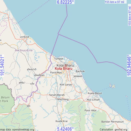
| Upper-left | 6.82225°, | 101.54021° |
| Center: | 6.12361°, | 102.24333° |
| Lower-right: | 5.42406°, | 102.94646° |
| Map W x H: | 155.5×155.5 km | = 96.6×96.6mi |
| max Lat: | 6.88732° ⇑8.4% North |
| Kota Bharu: | 6.12361° |
| min Lat: | ⇓91.6% South 1.24722° |
| min Long | Kota Bharu | max Long |
| 99.68252° | 102.24333° | 118.61119° |
| W 55.1%⇐ | ⇒44.9% E |
Elevation
Elevation of Kota Bharu is 1 m = 3 ft, and this is 43.7 m = 143 ft below average elevation for this country.
| Max E: |
1488 m = 4882 ft | 99.4% |
| Avg. | 44.7 m = 147 ft | |
| Kota Bharu | 1 m = 3 ft | |
Min E: |
0 m = 0 ft | 0.6% |
See also: Kota Bharu elevation on elevation.city.
Geographical zone
Kota Bharu is located in North Torrid zone (between Equator and Tropic of Cancer). Distance of Equator is 680.9 km =423.1 mi to South.| Distance of | km | miles | from Kota Bharu |
|---|---|---|---|
| North Pole | 9326.2 | 5795 | to North |
| Arctic Circle | 6720.3 | 4175.8 | to North |
| Tropic Cancer | 1925 | 1196.1 | to North |
| Equator | 680.9 | 423.1 | to South |


Nearby cities:
15 places around Kota Bharu: (largest is in red/bold)
• Gua Musang
141.1 km =87.7 mi,  192°
192°
• Jertih
51.2 km =31.8 mi,  147°
147°
• Kampong Kadok
13.8 km =8.6 mi,  176°
176°
• Kampong Pangkal Kalong
23.2 km =14.4 mi, 187°
• Kampung Kuala Besut
46.9 km =29.1 mi,  133°
133°
• Kampung Lemal
15.3 km =9.5 mi,  227°
227°
• Ketereh
18.5 km =11.5 mi, 178°
• Kuala Besut
47.3 km =29.4 mi, 133°
• Kuala Terengganu
132.8 km =82.5 mi, 131°
• Marang
147.5 km =91.7 mi, 133°
• Pasir Mas
14.1 km =8.8 mi, 234°
• Peringat
11 km =6.8 mi,  156°
156°
• Pulai Chondong
28.1 km =17.5 mi, 182°
• Tanah Merah
37.4 km =23.2 mi,  196°
196°
• Tumpat
11.5 km =7.1 mi,  315°
315°
In other languages:
- In France: Kota Bahru
- In German: Kota Bahru
- In Russian: Кота-Бару
- In Chinese: 哥打巴鲁
Sources, notices
• [Note1] Compared only with cities in Malaysia existing in our database
• [Src1] Map data: © OpenStreetMap contributors (CC-BY-SA)
• [Src2] Other city data from geonames.org with taken over terms of usage.
• [Src3] Geographical zone / Annual Mean Temperature by Robert A. Rohde @ Wikipedia
