Kuala Terengganu geodata
Kuala Terengganu (Terengganu) is a seat of a first-order administrative division; located in Malaysia in Asia/Kuala_Lumpur (GMT+8) time zone. With population of 285,065 people, there are 16 cities with bigger population in this country. Compared to other cities in Malaysia, 69.1% of cities are located further ↓South; 70.2% of cities are located further ←West and 52.2% of cities have lower elevation than Kuala Terengganu. Note1


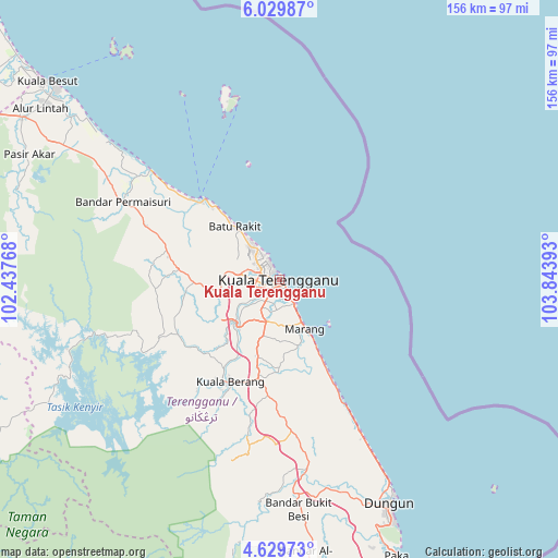
Kuala Terengganu GPS coordinates[2]
5° 19' 48.72" North, 103° 8' 26.88" East
| Map corner | latitude | longitude |
|---|---|---|
| Upper-left | 6.02987°, | 102.43768° |
| Center: | 5.3302°, | 103.1408° |
| Lower-right: | 4.62973°, | 103.84393° |
| Map W x H: | 155.7×155.7 km | = 96.7×96.7mi |
| max Lat: | 6.88732° ⇑30.9% North |
| Kuala Terengganu: | 5.3302° |
| min Lat: | ⇓69.1% South 1.24722° |
| min Long | Kuala Terenggan | max Long |
| 99.68252° | 103.1408° | 118.61119° |
| W 70.2%⇐ | ⇒29.8% E |
Elevation
Elevation of Kuala Terengganu is 15 m = 49 ft, and this is 29.7 m = 97 ft below average elevation for this country.
| Max E: |
1488 m = 4882 ft | 47.8% |
| Avg. | 44.7 m = 147 ft | |
| Kuala Terengganu | 15 m = 49 ft | |
Min E: |
0 m = 0 ft | 52.2% |
See also: Kuala Terengganu elevation on elevation.city.
Geographical zone
Kuala Terengganu is located in North Torrid zone (between Equator and Tropic of Cancer). Distance of Equator is 592.7 km =368.3 mi to South.| Distance of | km | miles | from Kuala Terengganu |
|---|---|---|---|
| North Pole | 9414.4 | 5849.8 | to North |
| Arctic Circle | 6808.5 | 4230.6 | to North |
| Tropic Cancer | 2013.3 | 1251 | to North |
| Equator | 592.7 | 368.3 | to South |


Nearby cities:
15 places around Kuala Terengganu: (largest is in red/bold)
• Cukai
123.9 km =77 mi,  165°
165°
• Jertih
84.9 km =52.8 mi,  301°
301°
• Kampong Kadok
123.5 km =76.7 mi,  307°
307°
• Kampong Pangkal Kalong
121.3 km =75.4 mi, 302°
• Kampung Kuala Besut
86 km =53.4 mi, 310°
• Kampung Lemal
135.2 km =84 mi, 305°
• Kertih
96.9 km =60.2 mi,  159°
159°
• Ketereh
120.9 km =75.1 mi, 305°
• Kota Bharu
132.8 km =82.5 mi, 311°
• Kuala Besut
85.6 km =53.2 mi, 310°
• Marang
15.6 km =9.7 mi,  152°
152°
• Paka
83.7 km =52 mi, 156°
• Peringat
122.9 km =76.4 mi, 309°
• Pulai Chondong
117.2 km =72.8 mi, 300°
• Tanah Merah
121.5 km =75.5 mi, 295°
Sources, notices
• [Note1] Compared only with cities in Malaysia existing in our database
• [Src1] Map data: © OpenStreetMap contributors (CC-BY-SA)
• [Src2] Other city data from geonames.org with taken over terms of usage.
• [Src3] Geographical zone / Annual Mean Temperature by Robert A. Rohde @ Wikipedia
